
Carte des Environs de Batavia, Kaart van de Buitenstreeken van Batavia’
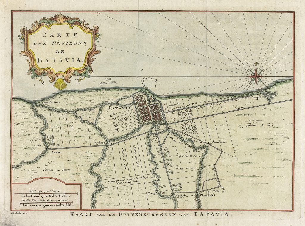
Jacobus van der Schley was a Dutch engraver and draughtsman active in Amsterdam in the mid-eighteenth century. He engraved maps, plans, views, and illustrations for historical and geographical publications, often adapting earlier Dutch material for new printed contexts. This map shows the district surrounding Batavia on the north coast of Java.
The map centres on the fortified city of Batavia and its immediate hinterland. It records the canals, rivers, roads, guard posts, gardens, rice fields, sugar-cane fields, and outlying settlements that supported the city. Place names such as Anjol, Jacatra, Noordwyk, Ankee, Vijfhoek, and Rijswijk locate Batavia within a wider colonial landscape of waterways, cultivated land, and controlled access routes.
Unlike a harbour chart, this map focuses on the landward organisation of Batavia. The city appears not simply as a coastal trading centre, but as the administrative and agricultural core of a managed Dutch colonial district. The emphasis on canals, rice fields, sugar-cane fields, and gardens shows the importance of water management, food supply, and plantation agriculture to the functioning of the Dutch East India Company’s Asian headquarters.
Within the collection, this map is closely connected with Sayer and Bennett’s Plan of the Road and City of Batavia (298), which shows Batavia from the perspective of the roadstead and maritime approach. It also relates to retrospective siege view (186) and to other Batavia and Java-related views, including Jan van Ryne’s Perspective view of Batavia (184), the later Paris optical version of Batavia (197), Georg Balthasar Probst’s De Reede van Batavia (475), Het Eiland Onrust, naby Batavia (185).
Schley, Jacobus van der (1715–1779)
Prévost, Antoine-François, Histoire générale des voyages, Paris: Didot, 1746–1770
c. 1760, bilingual Dutch/French issue
Copperplate engraving
188