
Plan of the Road and CIty of Batavia on the North Coast of Java Island
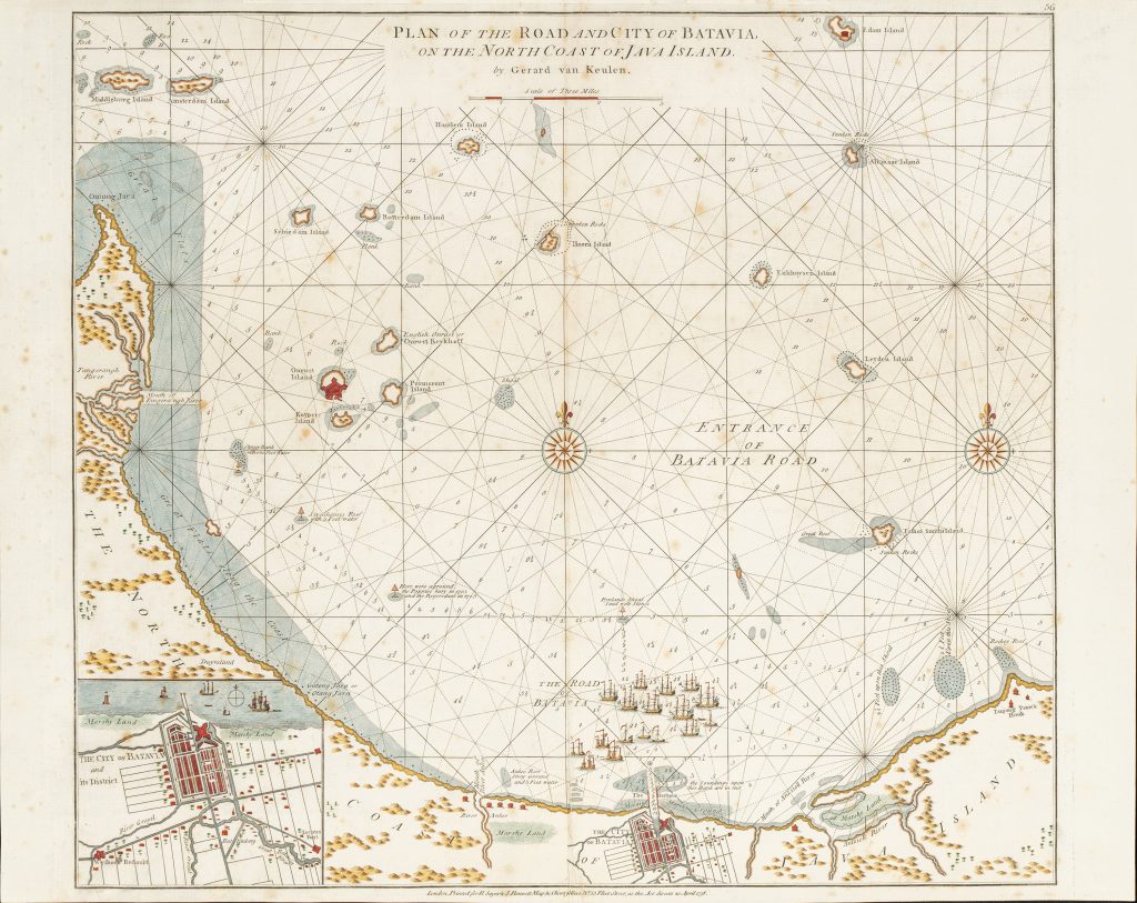
Robert Sayer and John Bennett were London map and chart publishers active in the later eighteenth century. Their Plan of the Road and City of Batavia, on the North Coast of Java Island, published in London on 20 April 1778, is an English copy of Gerard van Keulen’s Dutch chart of Batavia Road (349) first published in De nieuwe groote lichtende Zee-fakkel, vol. 5, in Amsterdam in 1728.
The chart centres on Batavia Road, the anchorage off the north coast of Java and the principal maritime approach to Batavia, the VOC headquarters in Asia. It records soundings, shoals, reefs, channels, islands, and coastal features needed by vessels approaching the harbour. Its English legends and translated navigational details show how Van Keulen’s Dutch hydrographic material was adapted for British maritime use. The inset at lower left shows the city of Batavia and its district, while the main chart extends across the roadstead and nearby islands. Onrust Island is particularly significant, as it served as a ship-repair and support station for vessels using Batavia. The chart also marks islands named after Dutch cities, including Amsterdam, Rotterdam, Haarlem, Leiden, and Enkhuizen, reflecting the Dutch colonial naming of the waters around Batavia.
This chart is valuable because it links hydrographic practice with colonial infrastructure. It is not simply a map of a harbour; it presents the working maritime system around Batavia, including the approach channels, repair islands, reefs, shoals, and the city itself. In doing so, it shows Batavia as both a fortified colonial capital and a practical navigational destination.
Within the collection, this English chart is directly connected with Gerard van Keulen’s original Dutch chart of Batavia Road (349). It also relates to Van Keulen’s two-sheet map of Java after Reland (261), Hendrick Doncker II’s earlier chart of Java (422), and the large VOC chart of Java (468), all of which show the continuing refinement of Dutch charting around Batavia and the Java coast. Van Keulen’s Sunda Strait and Bangka Strait charts (44and 45) provide further context for the western approaches to Batavia.
Sayer, Robert (1725–1794), and Bennett, John (fl. 1770–1787)
van Keulen, Gerard, De nieuwe groote lichtende Zee-fakkel, vol. 5, Amsterdam: Gerard van Keulen, 1728
1778, Sayer & Bennett English issue
1794, second English state: Robert Laurie and James Whittle, 1794
Copperplate engraving
298
R2 Very rare - one or two copies appear on the market