
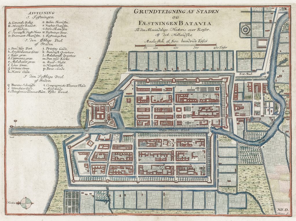
Grundteigning af staden og faestningen Batavia
Jonas Haas was a German-born engraver active in Copenhagen, where he produced maps, views, and book illustrations for Danish publications. This plan was engraved by Jonas Haas for Almindelige Historie over Rejser, the Danish translation of Prévost's Histoire générale des voyages, and was issued in vol. 12 in 1750.
The title reads Grundtegning af Staden og Fæstningen Batavia — a ground plan of the city and fortress of Batavia. The plan shows the walled city with its bastions, canals, streets, gates, public buildings, and surrounding suburbs. A numbered and lettered key at left identifies principal features, including the governor-general’s residence, the town hall, hospitals, gates, canals, quarters, and other civic and military structures.
The plan emphasises Batavia’s highly ordered urban form. The fortified core is set within a regular network of canals and streets, while the surrounding areas show suburban settlement, gardens, waterways, and cultivated land. The image presents Batavia not simply as a port, but as a planned colonial capital: fortified, administered, and connected to the wider commercial geography of Java and the East Indies.
Within the collection, this plan is closely connected with the companion map of the environs of Batavia (192), which places the city within its surrounding landscape of roads, canals, rivers, sugar fields, markets, and coastal approaches. It also relates to later sea charts centred on Java and the Sunda Strait, including Hendrick Doncker II’s chart of Java (422) and Samuel Dunn’s chart of the Sunda Strait (419). Together, these works show Batavia from different perspectives: as a fortified city, a colonial hinterland, and a strategic maritime centre.
Haas, Jonas (1720–1775)
Antoine François Prévost, Histoire générale des voyages, Paris, 1746–1759
1750, first Danish edition
Copperplate engraving
189