
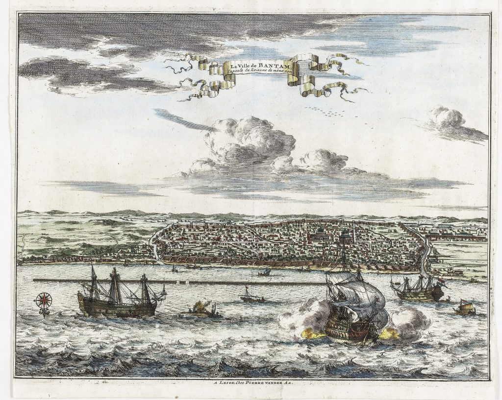
La Ville de Bantam capitale du Roiaume de même nom
Pieter van der Aa was a Leiden publisher, bookseller, and engraver active in the late seventeenth and early eighteenth centuries. Although not a mapmaker in the technical sense, he became a prolific compiler and publisher of maps, views, and charts, adapting earlier sources for works such as Le Nouveau Théâtre du Monde (1713), Atlas nouveau et curieux des plus célèbres itinéraires (1714), and La Galerie agréable du monde (1729).
This engraved view depicts Bantam, modern Banten, on the north-west coast of Java, once one of the most important trading ports in Southeast Asia. During the sixteenth and seventeenth centurie. During the sixteenth and seventeenth centuries, Bantam was a major centre of the spice trade and a focus of European commercial rivalry before the rise of Dutch-controlled Batavia.
The town is shown in elevated perspective across the harbour, with ships, fortifications, and coastal activity emphasised in the foreground. The composition presents Bantam as a maritime city, defined by its anchorage, trade, and position near the entrance to the Sunda Strait, a key route between the Indian Ocean and the Java Sea.
By the early eighteenth century, however, Bantam’s importance had declined as the Dutch East India Company consolidated its power in Batavia. Seen alongside the harbour charts of Bantam (195) and Batavia (190), this view records a port whose prominence was already fading at the time of publication.
Aa, Pieter van der (1659–1733)
Atlas nouveau et curieux des plus célèbres itinéraires, Leiden: Pieter van der Aa, 1714
1714, first
Copperplate engraving
187
R2 Very rare - one or two copies appear on the market