
Vue de l'Hotel de Batavie comme il se presente de devant sur la grande Place avec les Environs
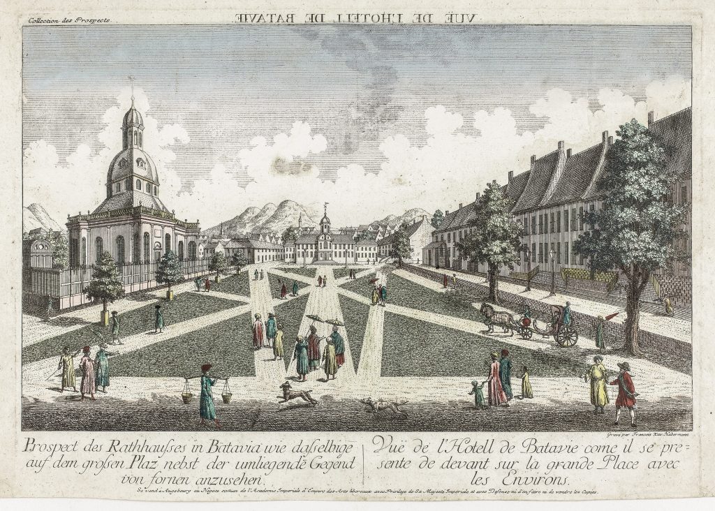
François Xavier Habermann was an Augsburg engraver and publisher known for producing perspective views of European and overseas cities for the popular eighteenth-century market in optical prints. This view of Batavia presents the city not through a map or plan, but as an urban prospect, showing the town hall and surrounding square as a civic centre of Dutch colonial power in Java.
The print is titled in French and German Vue de l’Hotell de Batavie comme il se presente de devant sur la grande Place avec les Environs and Prospect des Rathhauses in Batavia wie dasselbige auf dem grossen Platz nebst der umliegende Gegend von fornen anzusehen. The reversed title at the top indicates that the print was intended for viewing in an optical device, where the image would be seen corrected through a lens or mirror. Such prints were designed to give European viewers an immersive sense of distant places, combining topographical information with theatrical urban spectacle.
The scene shows the town hall and great square of Batavia, with formal paths, figures, carriages, and surrounding buildings arranged in strong perspective. The large church at left, the ordered civic space, and the distant mountains together present Batavia as a carefully structured colonial city. Although the image is idealised, it reflects European interest in Batavia as the administrative and commercial centre of the Dutch East India Company, or VOC, in Asia.
Within the collection, this view is closely connected with Jonas Haas’s plan of the city and fortress of Batavia (189) and his map of the environs of Batavia with a coastal prospect (192). Where 189shows Batavia as a fortified urban plan and 192places it in its wider coastal and agricultural setting, Habermann’s view presents the city as a civic and architectural spectacle for European audiences. It also relates to later charts centred on Java and the Sunda Strait, including Hendrick Doncker II’s chart of Java (422) and Samuel Dunn’s chart of the Sunda Strait (419), which show Batavia’s continuing importance within European maritime geography.
Habermann, François Xavier (1721–1796)
Series Collection des Prospects
c. 1750
Copperplate engraving
194