
Les Iles de Banda
Pieter van der Aa was a Leiden publisher, bookseller, and engraver active in the late seventeenth and early eighteenth centuries. Although not a mapmaker in the technical sense, he became a prolific compiler and publisher of maps, views, and charts, adapting earlier sources for works such as Le Nouveau Théâtre du Monde (1713), Atlas nouveau et curieux des plus célèbres itinéraires (1714), and La Galerie agréable du monde (1729).
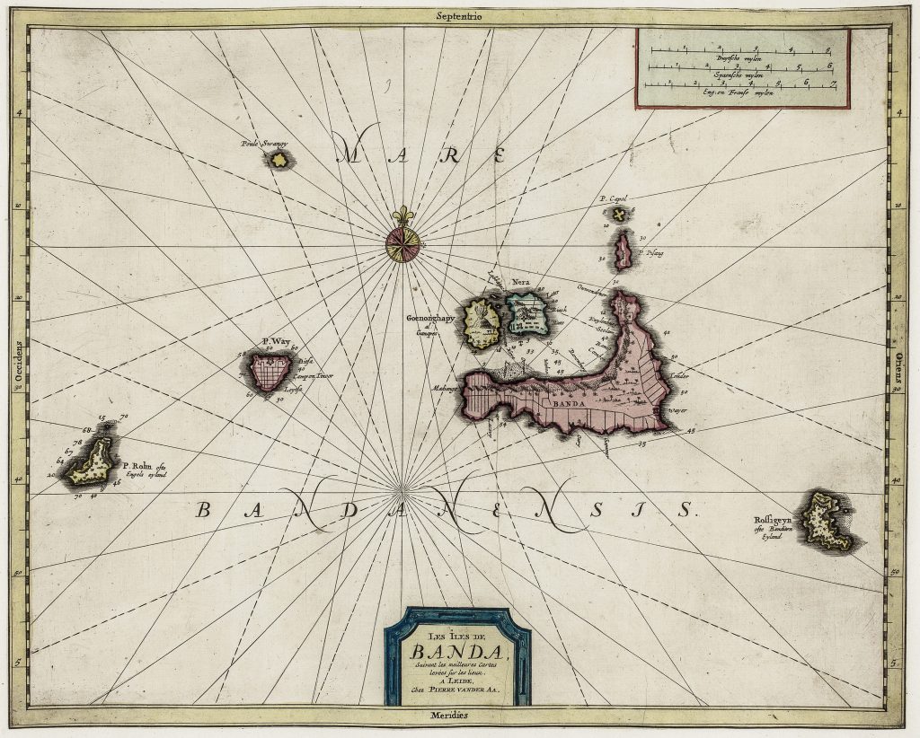
Few island groups were more significant to early modern European commerce than the Banda Islands. They were the principal source of nutmeg and mace for European trade, commodities that drove commercial competition, maritime violence, and colonial expansion in Southeast Asia. This chart is organised as a working sea chart rather than a land-focused map. The islands are set within a field of radiating rhumb lines, indicating navigational bearings, while the surrounding waters are marked with soundings and coastal detail. The landmasses are rendered schematically, reflecting their role as navigational markers within the Banda Sea.
The title states that the chart is based on les meilleures cartes levées sur les lieux (“the best maps surveyed on location) emphasising its reliance on observational knowledge. The wide expanse of surrounding sea reinforces the isolation of these small but commercially important islands. It should be read alongside Van der Aa’s related charts of Batavia (#19~0) ~and Bantam (195), and his view of Bantam (187), which together show how European publishers presented Southeast Asian ports and island groups as navigational, commercial, and strategic spaces.
Aa, Pieter van der (1659–1733)
Atlas nouveau et curieux des plus célèbres itinéraires, Leiden: Pieter van der Aa, 1714
1714, first
later reissued in La Galerie agréable du monde, Leiden: Pieter van der Aa, c. 1729
Copperplate engraving
193
R2 Very rare - one or two copies appear on the market