
La Rade de Bantam
Pieter van der Aa was a Leiden publisher, bookseller, and engraver active in the late seventeenth and early eighteenth centuries. Although not a mapmaker in the technical sense, he became a prolific compiler and publisher of maps, views, and charts, adapting earlier sources for works such as Le Nouveau Théâtre du Monde (1713), Atlas nouveau et curieux des plus célèbres itinéraires (1714), and La Galerie agréable du monde (1729).
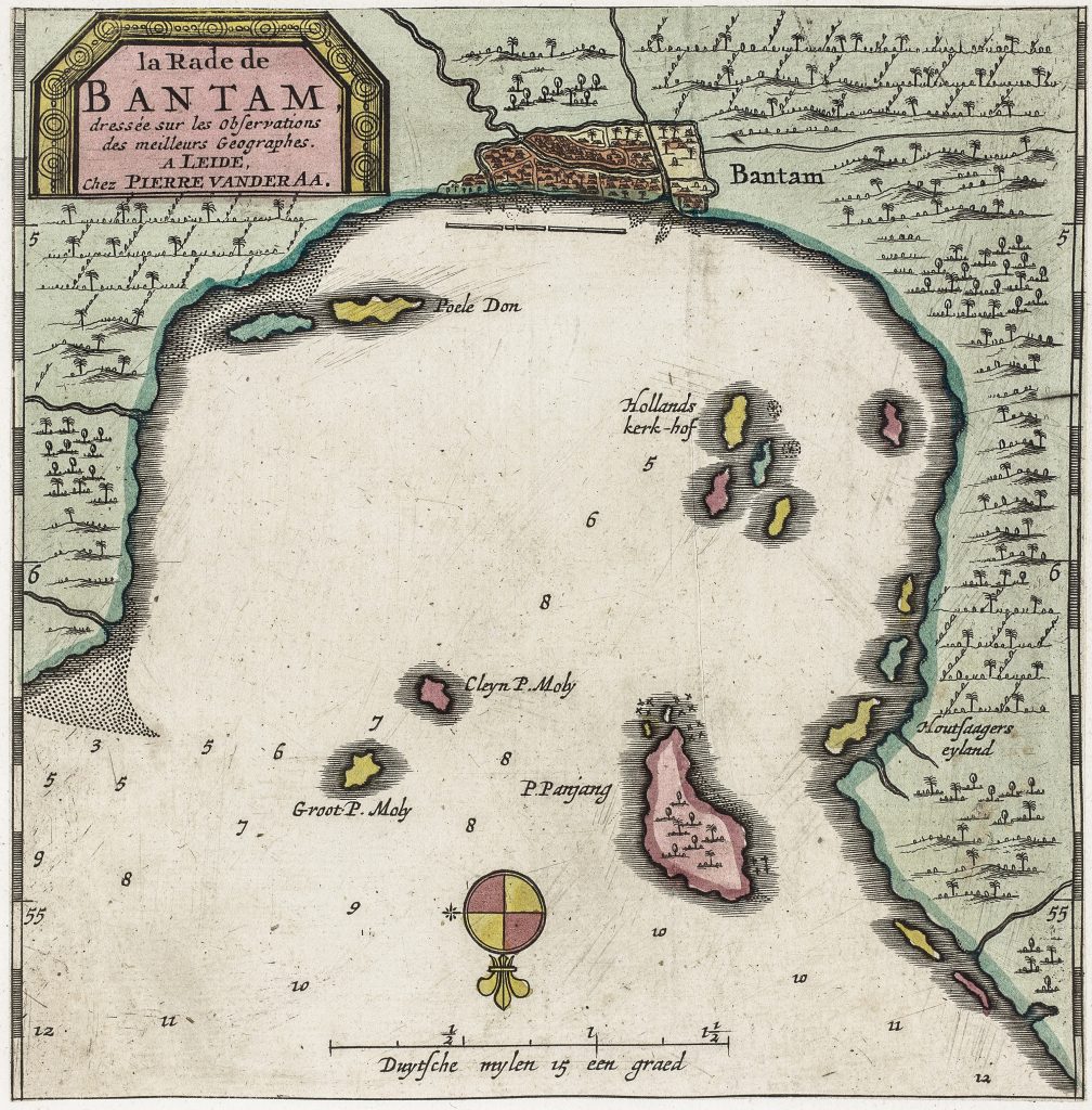
This harbour chart shows Bantam at the entrance to the Sunda Strait, a strategic anchorage for vessels sailing between the Indian Ocean and the Java Sea. During the sixteenth and seventeenth centuries, Bantam was a focus of European competition in the spice trade. The fortified settlement appears as a small grid at the head of the bay, while the anchorage dominates the composition. Depth soundings are scattered across the water, guiding ships toward safe mooring, and the scale in Dutch miles underscores the chart’s practical purpose. Offshore islands, including Hollands Kerk-hof (“Dutch Churchyard”), serve as navigational markers and reflect earlier Dutch activity in the harbour.
Inland detail is minimal, reinforcing the chart’s focus on channels, approach routes, and the working space of maritime trade. It records Bantam at a time when it remained an important harbour, even as Dutch power had shifted toward Batavia.
Within the collection, this chart is closely connected with Van der Aa’s related view of Bantam (187) and his chart of Le Détroit de la Sonde (196), which together place the port within the wider maritime geography of western Java and the Sunda Strait.
Aa, Pieter van der (1659–1733)
Atlas nouveau et curieux des plus célèbres itinéraires, Leiden: Pieter van der Aa, 1714
1714, first
later reissued in La Galerie agréable du monde, Leiden: Pieter van der Aa, c. 1729
Copperplate engraving
195
R2 Very rare - one or two copies appear on the market