
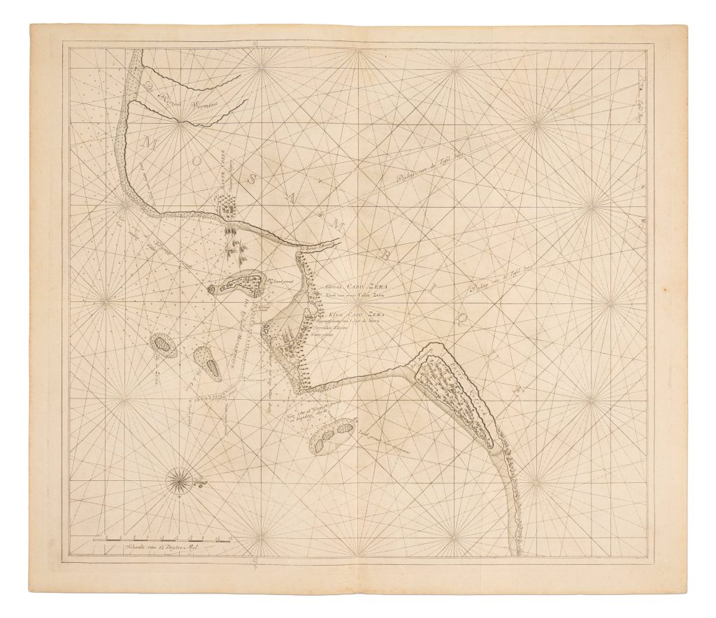
Paskaart van de kust van Mozambique
The Van Keulen publishing house, In de Gekroonde Lootsman (“In the Crowned Pilot”), was founded in Amsterdam by Johannes van Keulen I in 1678 and became one of the leading Dutch firms producing maps, sea charts, atlases, and pilot books. After Johannes I and his son Gerard developed the business, it passed to Gerard’s son, Johannes van Keulen II. Johannes II is especially known for issuing the sixth and final volume of De nieuwe groote lichtende Zee-fakkel in 1753, devoted to Asian and Indian Ocean navigation. The volume brought into print closely guarded VOC hydrographic knowledge, including information derived from manuscript charts and sailing directions that had previously been restricted because of their commercial and strategic value.
This chart shows the coast of Mozambique and adjoining waters in the western Indian Ocean. The coast is shown with reefs, shoals, islands, anchorages, coastal names, and sailing directions, all set within a dense network of rhumb lines. The chart was intended for pilots sailing along the East African coast and through the Mozambique Channel, a major route for ships travelling between the Cape of Good Hope and the Indian Ocean. coastal form, hazards, bearings, and usable maritime information. Its inclusion in the 1753 Zee-fakkel marks the moment when guarded Dutch manuscript knowledge of African and Asian waters was selectively converted into printed form.
Within the collection, this chart relates closely to Johannes van Keulen II’s chart of Java (261). It also provides a later practical counterpart to the Jan Huygen van Linschoten maps of South and East Africa (277and 278).
De nieuwe groote lichtende Zee-fakkel, vol. 6, Amsterdam: Johannes van Keulen II, 1753
1753, first
Copperplate engraving
486
Only copy