
Le Détroit de la Sonde
Pieter van der Aa was a Leiden publisher, bookseller, and engraver active in the late seventeenth and early eighteenth centuries. Although not a mapmaker in the technical sense, he became a prolific compiler and publisher of maps, views, and charts, adapting earlier sources for works such as Le Nouveau Théâtre du Monde (1713), Atlas nouveau et curieux des plus célèbres itinéraires (1714), and La Galerie agréable du monde (1729).
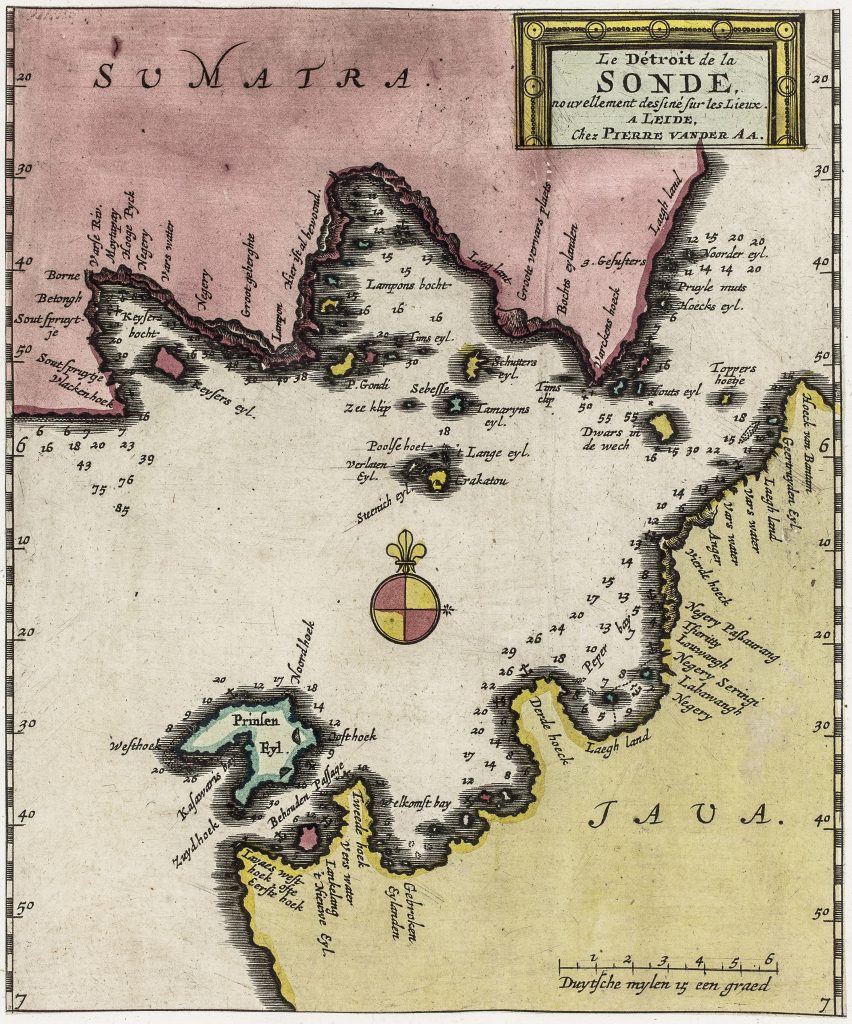
This chart of the Sunda Strait depicts the Sunda Strait between Java and Sumatra, one of the most important maritime passages linking the Indian Ocean with the Java Sea and the principal sea route to Batavia. Control of this narrow waterway was strategically significant to both regional and European trade. The composition functions as a working navigational chart. Coastlines are clearly defined, inland detail is minimal, and depth soundings are distributed across the strait to guide safe passage. The island group in mid-channel, including Crakatou (Krakatoa) and neighbouring islets such as Lange eyl. and Seboesse, is prominently marked as a key navigational reference within the narrowest part of the passage.
The phrase nouvellement dessiné sur les lieux (newly drawn on location) presents the chart as based on direct observation rather than purely inherited compilation. A compass rose and scale in Dutch miles further emphasise its practical purpose, presenting the strait not as a general geographical outline but as a closely observed maritime corridor within the trading networks of Southeast Asia.
Within the collection, this chart is closely connected with Van der Aa’s harbour chart of Bantam (195), his view of Bantam (187) and his chart of Batavia (190), which together present the port, town, and maritime approaches to western Java.
Aa, Pieter van der (1659–1733)
Nouvel Atlas, Leiden: Pieter van der Aa, 1714
1714, first
later reissued in La Galerie agréable du monde, Leiden: Pieter van der Aa, c. 1729
Copperplate engraving
196
R2 Very rare - one or two copies appear on the market