
Carte Particuliere Des Costes De L’Afrique Depuis C.
Del Gado Jusques Rio Mocambo, et les Isles aux Environs
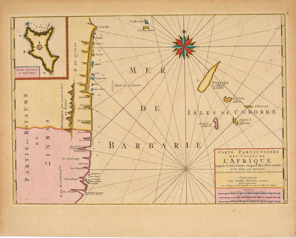
Pierre Mortier issued this sea chart in Amsterdam in 1708 as part of his expanded edition of the Neptune François.
The Neptune François had first appeared in 1693 through the French-Dutch publishing collaboration of Alexis-Hubert Jaillot in Paris and Mortier in Amsterdam.
Mortier’s later edition extended the atlas’s reach beyond European waters and into the wider commercial routes of the Atlantic and Indian Oceans.
This chart covers the eastern coast of Africa from Cape Delgado southward to the Rio Mocambo, just beyond Mozambique, and extends east across the western Indian Ocean.
It was made for maritime use: coastal names, soundings, shoals, islands, rhumb lines, and a large compass rose organise the sheet for navigation along the East African coast and through the approaches to the Indian Ocean.
The Comoro Islands are a major feature.
Grande Comore, Mohéli, Anjouan, and Mayotte appear individually, with Mayotte labelled under its early form Motale ou I.
Mayote. An inset of Anjouan in the upper left gives the island additional emphasis.
This reflects the strategic value of the Comoros as staging points in maritime routes linking East Africa, Arabia, India, and Southeast Asia.
The coastal nomenclature shows strong reliance on Portuguese hydrographic knowledge, consistent with Portugal’s long presence in the western Indian Ocean.
Yet the chart was published in Amsterdam, within a Dutch and French commercial atlas context.
It therefore shows how information first developed through Portuguese navigation could be republished, reorganised, and circulated through later European chart publishing.
After Mortier’s death in 1711, the plates were acquired by Gerard van Keulen, and later issues appeared with his imprint.
This continued use of the plate shows the practical value of the chart within eighteenth-century nautical publishing.
Within the collection, this chart is closely connected with Johannes Loots’s Indian Ocean chart (4), which carries the maritime geography eastward toward Batavia, Southeast Asia, and New Holland.
It also relates to Pierre Mariette’s East Indies map (354), Herman Moll’s East Indies map (136).
Together, these works show how Africa’s eastern coast formed part of the same maritime world as Arabia, India, the East Indies, and the approaches to Australia.
Mortier, Pierre (1661–1711)
Neptune François, Amsterdam: Pierre Mortier, 1708
1708, first
Later Gerard van Keulen issues after acquisition of the plates
Copperplate engraving
471
R2 Very rare - one or two copies appear on the market