
Tabula Indiae Orientalis
Frederik de Wit began his career as an apprentice to Willem Blaeu before establishing his own publishing house in Amsterdam in 1648 under the sign De Drie Crabben (the Three Crabs).
In 1655, he renamed his shop Witte Pascaert (the White Chart), from which he issued a wide range of cartographic works, including single-sheet maps, wall maps, atlases, and sea charts.
Renowned for their refined engraving and vivid hand-colouring, De Wit’s productions rank among the most admired of seventeenth-century Dutch cartography.
His major publications include Atlas Belgium (1667), Atlas(c. 1670), Atlas Minor (1670), Zee Atlas (1675), Orbis Maritimus ofte Zee Atlas (1675), and Atlas Major(1690s).
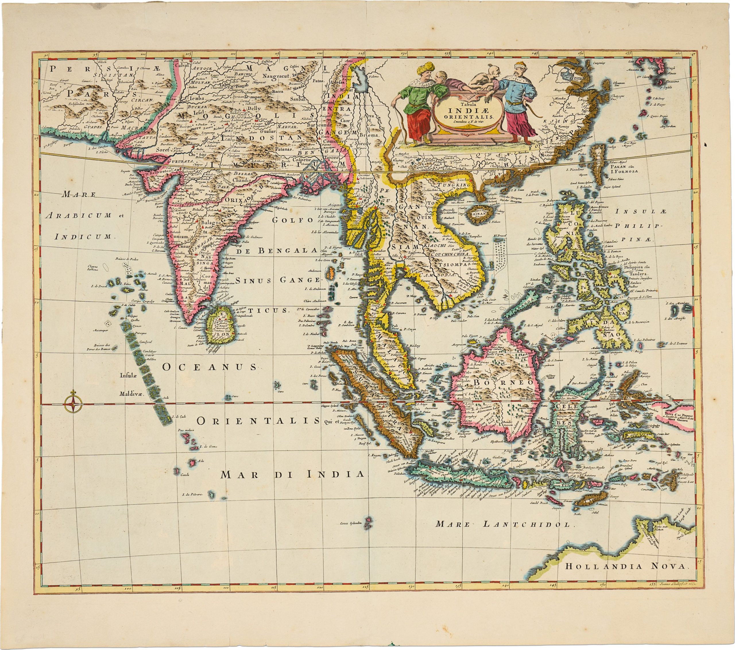
This map of the East Indies depicts the maritime regions of South and Southeast Asia, extending from India to the Indonesian archipelago.
Issued in Amsterdam in 1662, it reflects the Dutch Republic’s dominance in Asian trade and navigation during the Golden Age of Dutch cartography.
The map emphasises coastal outlines, principal ports, islands, and sea routes, underscoring its commercial and nautical function.
As with many Dutch maps of the period, the map integrates geographic intelligence derived from VOC trading networks with contemporary European cartographic conventions, illustrating the strategic and economic importance of the East Indies within early modern global trade systems.
Wit, Frederick de (c. 1629/30–1706)
1662, Amsterdam
1662, First
Copperplate engraving
470