
Mappe-Monde pour connoitre les progres & les conquestes des Provinces-Unies
Zacharie Châtelain was a Huguenot publisher and compiler active in Amsterdam, now generally regarded as the principal compiler of the Atlas historique, although the work has traditionally been attributed to Henri Abraham Châtelain. Published between 1705 and 1720, the Atlas historique combined geography, chronology, history, genealogy, politics, religion, commerce, and travel, making it one of the most ambitious illustrated geographical encyclopaedias of the early eighteenth century. Its maps, views, diagrams, and historical essays were intended not simply to describe the world, but to place geographical knowledge within a broader framework of history and human affairs. The work was also rich in material concerning civil, military, commercial, and ecclesiastical governance, including plates on the Dutch East India Company (249) and the States of the Seven United Provinces (250).
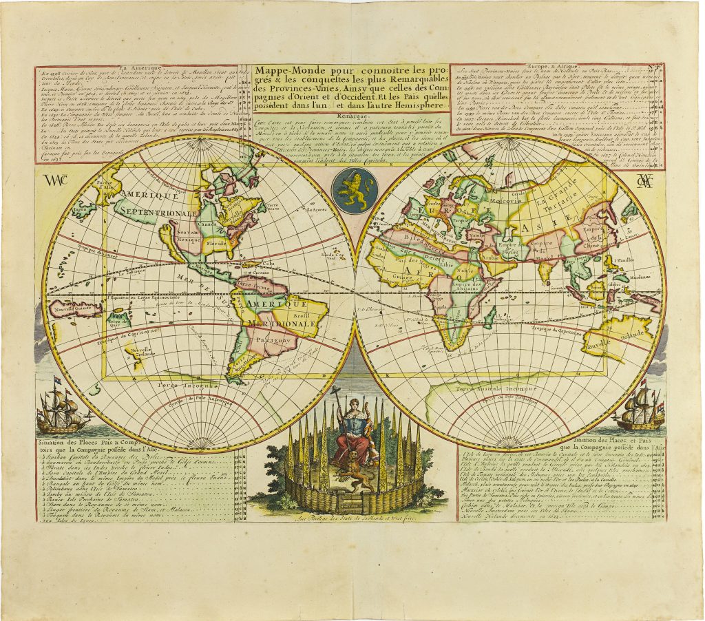
The Atlas historique included numerous maps, often drawing on contemporary French cartography and geographical compilation. This world map was included in volume 1, first published in 1705. One of two world maps from volume 1 represented in this collection, the other is 247. This world map was designed to show the possessions, conquests, and commercial reach of the United Provinces and of the Dutch East and West India Companies. The title directs the viewer to read the map politically, as a visual account of places connected to the Dutch Republic and its chartered trading companies in both hemispheres.
The map shows California as an island and gives a partial outline of Australia and New Zealand. In the western Pacific, the map includes the supposed Terre de Quir, associated with Pedro Fernández de Quirós and the long-lived belief that his discoveries might belong to a great southern land. The shape and placement of Japan are also distorted, reflecting the uncertainties that continued to affect European mapping of East Asia and the Pacific. The decorative imagery reinforces the map’s political theme. A Dutch lion appears in a central medallion, while ships in the surrounding oceans evoke the maritime activity of the Dutch trading companies. The map therefore presents geography as an imperial and commercial network, with overseas possessions, voyages, and trading routes arranged around the power of the United Provinces. It should be read alongside the related Châtelain plates on the government of the Dutch Republic (250), the Dutch East India Company (249), and Java and Batavia (353).
Chatelain, Henri Abraham (1684–1743)
Atlas historique, ou nouvelle introduction à l’histoire, à la chronologie & à la géographie ancienne & moderne, vol. 1, Amsterdam: L’Honoré & Châtelain, 1705
TBA
Copperplate engraving
248
R3 Uncommon - dealers can usually obtain a copy