
Terza Tavola
Ferrando Bertelli was a Venetian engraver and map publisher active in the mid-sixteenth century. Like other members of the Bertelli publishing circle, he issued separately published maps that adapted recent geographic sources for the Venetian print market.
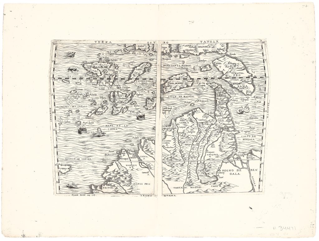
This rare engraved map of Southeast Asia, commonly known as Terza Tavola (“Third Plate”), was published separately in Venice in 1565. It is based on Giacomo Gastaldi’s 1554 woodcut map (28), first published in vol. 1 of Giovanni Battista Ramusio’s Navigationi et Viaggi (352). The map is oriented with south at the top and extends from Sumatra in the west to the Philippines in the east. It encompasses the Malay Peninsula, Borneo, Java, the Moluccas, and surrounding islands, a region central to European commercial interest because of the spice trade.
Like Gastaldi’s version, the map includes the name “Filipina, ” among the earliest appearances of the Philippines on a European printed map. In the mainland interior, Bertelli also preserves Gastaldi’s depiction of the mythical Lago de Chiamay, imagined as the source of several major rivers flowing across mainland Southeast Asia. Although fictitious, the lake persisted on European maps for centuries, showing how printed cartography could combine reported geography, inherited conventions, and speculation. Printed as a separate sheet, Terza Tavola reflects the vibrant Venetian print culture of the 1560s. Its engraved format offered finer line work and greater durability than Gastaldi’s earlier woodcut, while preserving the visual structure and geographic content of the original. The map shows how voyage literature, print technology, and commercial demand shaped European knowledge of Southeast Asia.
Bertelli, Ferrando (c. 1525–1572)
Separate publication. Venice: Ferrando Bertelli, 1565
1565, first
Copperplate engraving
60
R1 Extremely rare - occasionally seen on the market