
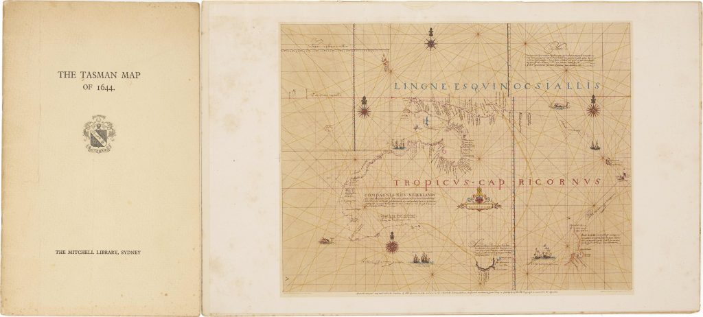
The Tasman Map of 1644
Phyllis Mander-Jones was an Australian librarian, bibliographer, and manuscript specialist associated with the Mitchell Library and the State Library of New South Wales. This booklet was published in Sydney by the Trustees of the Public Library of New South Wales in 1948. It provides a short historical account and description of the manuscript map long known as the Tasman or “Bonaparte” map.
The map discussed in the booklet was purchased in 1891 by Prince Roland Bonaparte and later presented to the Mitchell Library by Princess George of Greece in 1933. Although the map was traditionally associated with Abel Tasman and the year 1644, later scholarship has treated its authorship and dating more cautiously. Its importance lies in its connection with the Dutch mapping of Australia and the record of Tasman’s voyages in 1642–43 and 1644.
Mander-Jones, Phyllis (1896–1984)
Sydney: The Trustees of Public Library of New South Wales, Sydney, 1948
Letterpress
444