
Plan de Port Praslin à la Côte des Arsacides découvert par Surville en 1769
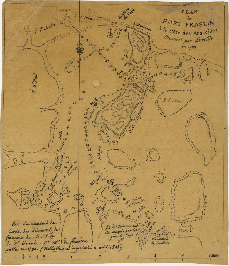
Louis Claude de Freycinet was one of the principal hydrographers of Nicolas Baudin’s expedition to the southern lands. This manuscript chart, attributed by Simon Dewez to Freycinet’s hand, copies a plan of Port Praslin on the Côte des Arsacides, the eighteenth-century French name for part of the Solomon Islands region. The title records that the harbour was discovered by Jean-François-Marie de Surville in 1769.
The source inscription at lower left states: Tiré du recueil des cartes des découvertes de la France au Sud-Est de la Nouvelle-Guinée. Par M. de Fleurieu publié en 1790. Bibliothèque Impériale 4 août 1808 —"Taken from the collection of maps of French discoveries in the South-East of New Guinea, by M. de Fleurieu, published in 1790. Imperial Library, 4 August 1808." This identifies Charles-Pierre Claret de Fleurieu’s published collection as the source and places the manuscript copy in Paris in August 1808.
The chart includes islands and coastal features named Île St. Paul, Île St. Charles, Île St. Jean, Île Marianne, Île de l’Aiguade, and Île St. Pierre, with soundings, reefs, shoals, anchorages, and a scale in miles. A note near the lower centre reads: Ici les batteaux ont été attaqués par les gens du pays — “Here the boats were attacked by the people of the country.” This annotation refers to the contact and conflict associated with Surville’s 1769 visit and gives the chart a historical as well as hydrographic significance.
Within the collection, this chart is closely connected with Freycinet’s manuscript copy after d’Anville (264), made at the Bibliothèque Impériale a few weeks earlier. It also relates to Freycinet’s printed maps of Nouvelle Hollande (20, 64, 168, and 39), the chart of Terre Napoléon (169), and the Partie navigation et géographie volume (263), which together show the movement from manuscript compilation and earlier voyage sources to the published cartography of the Baudin expedition.
Freycinet, Louis Claude (1779–1841)
Manuscript copy after Charles-Pierre Claret de Fleurieu, copied at the Bibliothèque Impériale, Paris, 4 August 1808
Manuscript, 4 August 1808
Manuscript chart in ink on paper
265
Only copy