
Copié S.th hémisphère oriental de l'ancien monde public par le S. Danville. Copie à la Bibliothèque Impériale le 24 Juin 1808
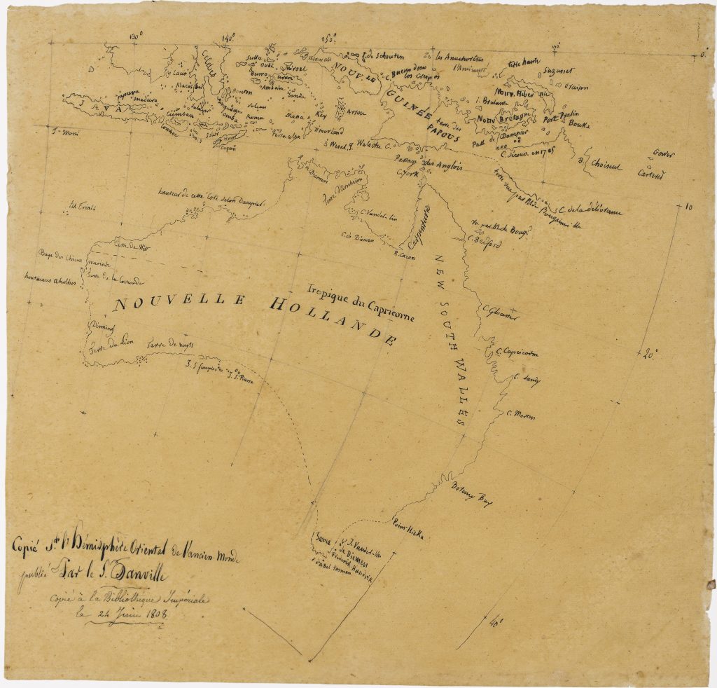
Louis Claude de Freycinet was one of the principal hydrographers of Nicolas Baudin’s expedition to the southern lands. This manuscript map, attributed by Simon Dewez to Freycinet’s hand, was copied at the Bibliothèque Impériale in Paris on 24 June 1808 from a map by Jean-Baptiste Bourguignon d’Anville. The inscription at lower left reads: Copié S.th l’hémisphère oriental de l’ancien monde publié par le Sr. d’Anville. Copié à la Bibliothèque Impériale le 24 juin 1808—"Copied from the Eastern Hemisphere of the Ancient World published by S. Danville. Copy at the Imperial Library on June 24, 1808."
The map shows Nouvelle Hollande, New Guinea, Java, the Moluccas, New Britain, the Solomon Islands, and parts of the western Pacific. It preserves an earlier geographical framework in which Australia is shown with a strong emphasis on Dutch discoveries and naming. Place names such as Nouvelle Hollande, Terre de Diémen, New South Wales, Carpentaria, and Nouvelle Guinée place Australia within the wider Indo-Pacific world of eighteenth-century European geographical compilation.
As a manuscript copy, the map is not a finished publication but a working document. Its value lies in showing Freycinet’s engagement with earlier cartographic sources while preparing the geographical and hydrographic record of the Baudin expedition. The date, 24 June 1808, places it in the period between the return of the expedition and the publication of Freycinet’s major atlas maps of Nouvelle Hollande and Terre Napoléon.
Within the collection, this manuscript is closely connected with Freycinet’s other manuscript chart of Port Praslin (265), copied from Fleurieu’s collection later in 1808. It also relates to Freycinet’s printed maps of Nouvelle Hollande (20, 64, 168, and 39) and his chart of Terre Napoléon (169), which show how manuscript compilation, earlier printed sources, and expedition surveys were transformed into the published cartography of the Baudin voyage.
Freycinet, Louis Claude (1779–1841)
Manuscript copy after Jean-Baptiste Bourguignon d’Anville, copied at the Bibliothèque Impériale, Paris, 24 June 1808
Manuscript, 24 June, 1808
Manuscript map in ink on paper
264
Only copy