
Orbis terrarum typus de integro multis in locis emendatus
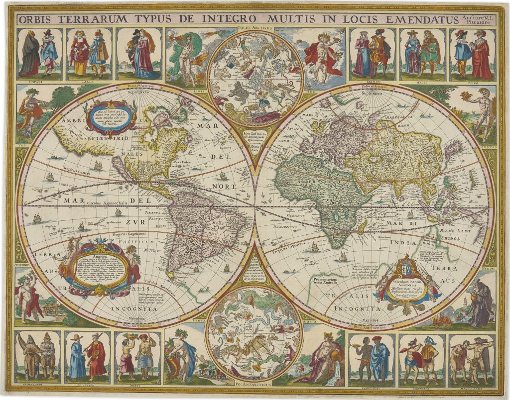
Nicolaes Visscher I was an Amsterdam engraver, mapmaker, and publisher who continued the Visscher family business after the death of his father, Claes Jansz. Visscher, in 1652. The Visscher firm was closely associated with the Dutch market for wall maps, atlas maps, Bible maps, and separately issued prints, and its plates were often revised, reissued, and adapted across several decades. This separately published world map was issued around that time and shows Visscher developing the family’s established world-map format into a richly decorated display of geography, astronomy, peoples, and natural philosophy.
The decorative border is among the most elaborate produced by the Visscher workshop. Above and below the double-hemisphere world map are celestial charts showing the constellations of the northern and southern skies, reflecting the close relationship between astronomy, navigation, and cartography. Around the map are twelve costume panels representing European conceptions of the world’s peoples, including Hispani, Galli, Itali, Germani, Angli, Belgae, Groenlandi, Chinenses, Javani, Guineenses, Peruuiani, and Magellanici.
Four additional panels depict the classical elements: Earth, Air, Fire, and Water. Together, the costume figures, celestial charts, and elemental allegories present the world as a geographic, cosmographic, and human order. The border is attributed to Pieter Goos, who collaborated with the Visscher family and whose engraving gives particular attention to costume, gesture, and allegorical detail.
Within the collection, this map is closely connected with Visscher’s Bible world maps (25and 93), which use a related double-hemisphere format but a different decorative programme.
Visscher I, Nicolaes (1618–1679)
Separate publication. Amsterdam: Nicolaes Visscher I, c. 1652
c. 1652, first
Copperplate engraving
287
R2 Very rare - one or two copies appear on the market