
Asia nova descriptio
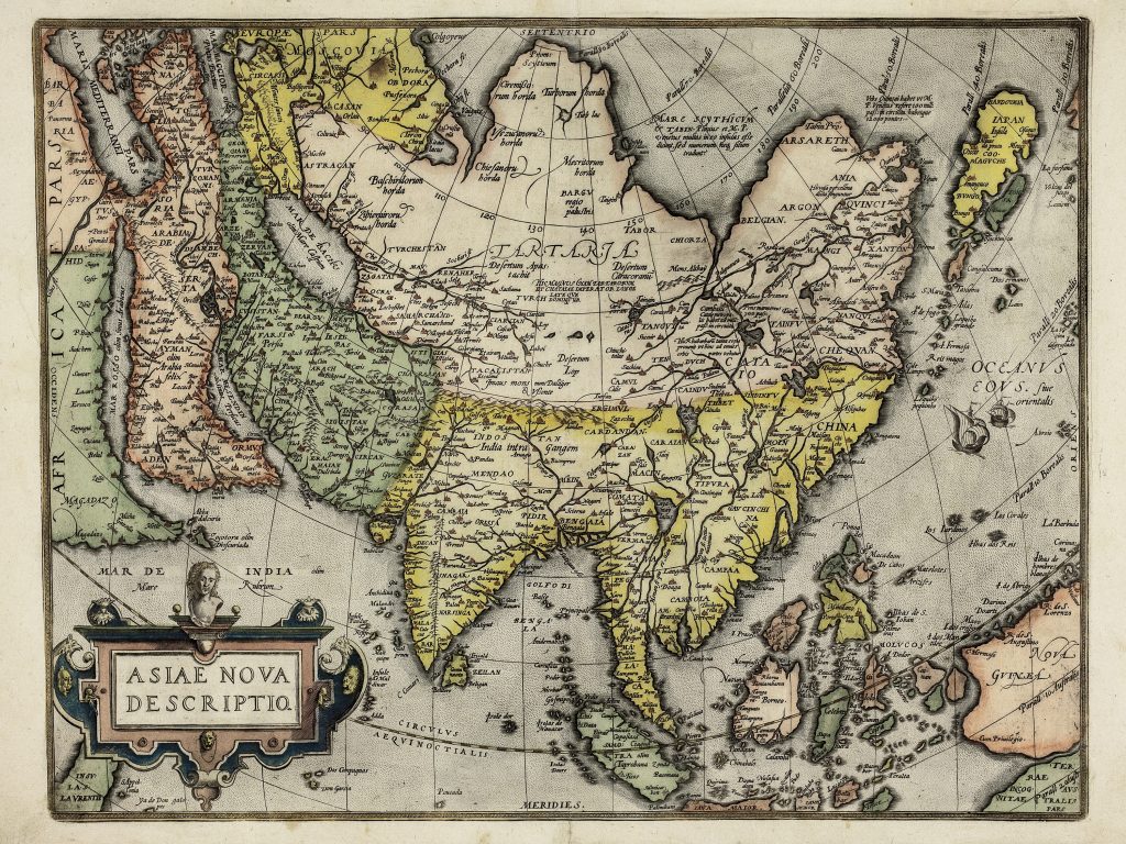
Abraham Ortelius was a Flemish cartographer, editor, and antiquarian whose Theatrum orbis terrarum, first published in Antwerp in 1570, became the defining printed atlas of the later sixteenth century (252for the 1584 edition). This map of Asia, first appeared in the 1570 edition of the Theatrum. It presents Asia from the eastern Mediterranean and Arabia to Japan, Southeast Asia, the Moluccas, and New Guinea. Ortelius drew heavily on earlier sources, especially the work of Giacomo Gastaldi, while also incorporating Portuguese geographical knowledge derived from voyages and trade in the Indian Ocean and East Indies.
The map reflects both expanding European knowledge and continuing uncertainty. Japan appears in an elongated form, the Philippines and Moluccas are shown as important island groups, and New Guinea is depicted as a large landmass whose relationship to the southern continent remains In the far north, speculative geography appears in features such as Arsareth, while Central Asia retains many classical and medieval place names.
The map is important as an early atlas representation of Asia and Southeast Asia before the more detailed Dutch mapping of the East Indies in the seventeenth century. It should be read alongside Ortelius’s related maps in the collection, including Americae sive Novi Orbis Nova Descriptio (221),
Ortelius, Abraham (1527–1598)
Theatrum Orbis Terrarum, Antwerp: Gilles Coppens de Diest, 1570
1570, first?
Copperplate engraving
200