
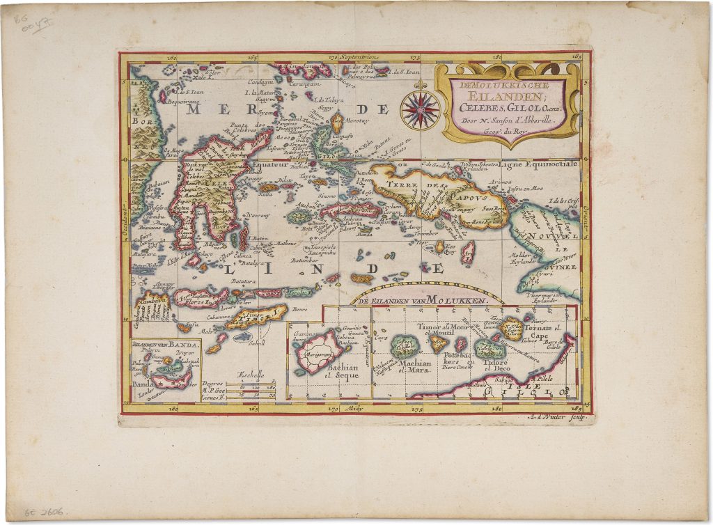
De Molukkische Eilanden; Celebes, Giliolo, enz
Nicolas Sanson was a French cartographer and royal geographer whose work helped establish a distinct French school of cartography in the mid-seventeenth century. Originally trained as a historian, he turned to mapmaking partly as a way of organising and illustrating historical and geographical knowledge. After his work attracted royal attention, he was appointed Géographe Ordinaire du Roi. His small-format continental atlases, including L’Asie en plusieurs cartes nouvelles et exactes, first published in Paris in 1652, presented Asia through a sequence of general and regional maps.
Among the seventeen maps featured in Sanson’s Asia atlas is this map of the Moluccas and neighbouring islands, engraved by Antoine de Winter. It covers Celebes, Gilolo or Halmahera, the Moluccas, the Lesser Sunda Islands, Timor, parts of New Guinea, and surrounding island groups. Two inset maps give enlarged treatment to the Banda Islands and the principal islands of the northern Moluccas, including Ternate, Tidore, Machian, Motir, and Bachian. The map belongs to the long European cartographic focus on the Spice Islands. By the mid-seventeenth century, the Moluccas were not only a geographical subject but a commercial and strategic one, bound to Dutch, Portuguese, Spanish, French, and English interest in cloves, nutmeg, mace, and sandalwood. Sanson’s map presents the region in a compact and orderly form, while the insets emphasise the small island groups whose products gave the region its commercial importance.
New Guinea appears along the right side of the map as Terre des Papous, showing the continuing difficulty of fixing the geography of the western Pacific and eastern Indonesian archipelago. The hand colour and gold illumination by Dirk Jansz. van Santen heightens the visual distinction between islands, coasts, seas, and political regions.
Within the collection, this map is directly connected with Petrus Plancius’s Insulae Moluccae celeberrimae (376and 72), which provides an earlier Dutch treatment of the same spice-producing region. It also relates to Sanson’s general map of Asia (401), his map of the Sunda Islands (402), and his map of mainland Southeast Asia and the Malay Peninsula (403), which together place the Moluccas within a larger Asian and Indo-Pacific geography.
Sanson, Nicolas (1600–1667)
L'Asie en plusieurs cartes nouvelles et exactes..., Paris: Nicolas Sanson, 1652
1653–1660, Dutch
Copperplate engraving
404
R2 Very rare - one or two copies appear on the market