
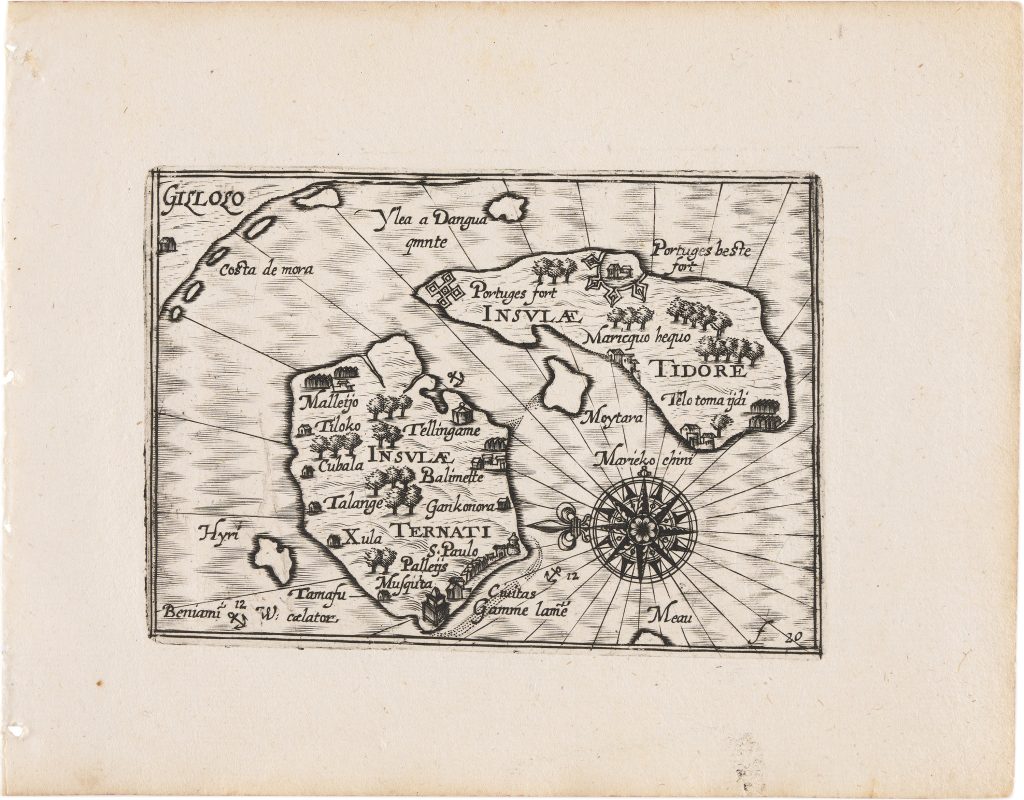
Insulae Ternati - Insulae Tidore
In 1649 Claes Jansz. Visscher reworked and expanded Barent Langenes’s Caert-thresoor, first published in Amsterdam in 1598 by Cornelis Claesz. as Tabularum geographicarum contractarum libri quatuor denuo recogniti. The compact atlas was divided into four parts: Europae (introduced by the title page 10), Asiae, Africae, and Americae. Alongside the inherited Langenes material, Visscher added twenty-three newly engraved maps, including plates relating to Dutch discoveries in Australia and the East Indies: Anthoni van Diemens Landt (11), ’t Landt van de Eendracht (12), Iava Maior (371), and two Benjamin Wright plates of Ternate–Tidore represented here, and Madura (370). The atlas also incorporated revised versions of the earlier Hondius world maps, Typus orbis terrarum (292) and Iehova (293).
This map present the islands of Ternate and Tidore as they were understood following the second Dutch voyage to the East Indies (1598–1600), led by Jacob van Neck with Wybrand van Warwijck as vice-admiral. The fleet reached the Spice Islands in 1599, establishing trading relations and gathering detailed navigational intelligence. The map presents the clove-producing islands of Ternate and Tidore in detailed profile, underscoring their strategic and commercial importance within the Moluccan spice trade. Portuguese fortifications are prominently identified, including “S. Paolo” on Ternate and two sites on Tidore labelled “Portuges fort” and “Portuges beste fort, ” recording the still-visible, though increasingly vulnerable, Portuguese military presence in the region at the turn of the seventeenth century.
The concentration of named coastal settlements, including Talange, Gonsora, Cubala, Telingame, together with marked anchorages and defensive sites, reflects the practical priorities of the second Dutch expedition, for which control of harbours and proximity to clove-producing districts were critical. The engraving therefore functions not merely as a topographical representation but as record of commercial and strategic intelligence, capturing the islands at a pivotal moment in the intensifying European content for dominance in the spice trade.
Within the collection, this map provides an early printed view of the Moluccan spice islands and should be compared with Willem Jansz. Blaeu’s later Moluccae insulae celeberrimae (387). Read alongside Visscher’s Iava Maior (371), it also shows how Dutch printed cartography connected the spice-producing islands of the Moluccas with Java and the wider East Indies trading network.
Wright, Benjamin (1575–1613)
Tabularum geographicarum contractarum libri quatuo, denuo recogniti, Amsterdam: Claes Jansz. Visscher, 1649
1649, first
Copperplate engraving
369
R1 Extremely rare - occasionally seen on the market