
A Prospect of the Town of Batavia: A View of the Citadel of Batavia
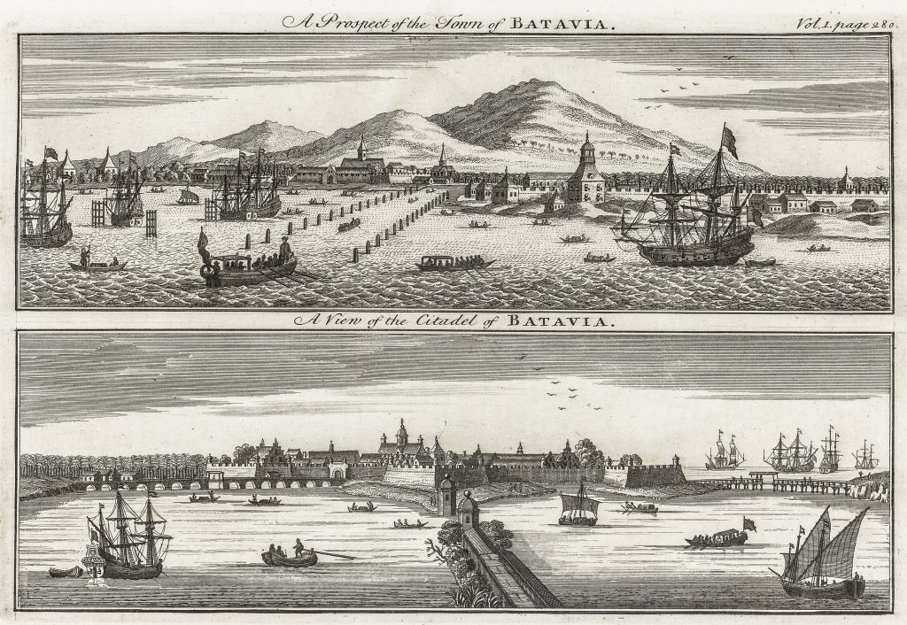
John Harris’s Navigantium atque itinerantium bibliotheca, or A Complete Collection of Voyages and Travels, was an English compilation of travel accounts that brought descriptions of overseas places to an eighteenth-century readership. This engraved sheet presents two views of Batavia, the Dutch East India Company’s principal Asian headquarters on the north coast of Java.
The upper view, titled A Prospect of the Town of Batavia, shows the city from the water, with ships, small boats, quays, church towers, and mountains in the background. The lower view, A View of the Citadel of Batavia, focuses more closely on the fortified waterfront and citadel, with vessels and rowing boats in the foreground. Together, the two images present Batavia as both a trading port and a fortified colonial centre.
he print belongs to a wider European visual culture in which important overseas cities were represented through prospects, harbour views, and published travel compilations. Such views were not navigational charts, but they helped readers imagine the maritime and urban settings described in voyage literature. In this case, Batavia is shown as an ordered Dutch colonial city, defended by fortifications and animated by shipping.
Within the collection, this view is closely connected with Jonas Haas’s plan of Batavia (189), his map of the environs of Batavia with a coastal prospect (192), and François Xavier Habermann’s optical view of the town hall and great square of Batavia (194). Where 189maps the fortified city, 192places Batavia in its surrounding coastal and agricultural setting, and 194presents its civic space as an optical spectacle, this English print offers two compact harbour views for readers of voyage literature. It also relates to later charts of Java and the Sunda Strait, including Hendrick Doncker II’s chart of Java (422) and Samuel Dunn’s chart of the Sunda Strait (419).
Harris, John (c. 1666–1719)
Navigantium atque itinerantium bibliotheca, vol. 1, London, 1744
1744
Copperplate engraving
208