
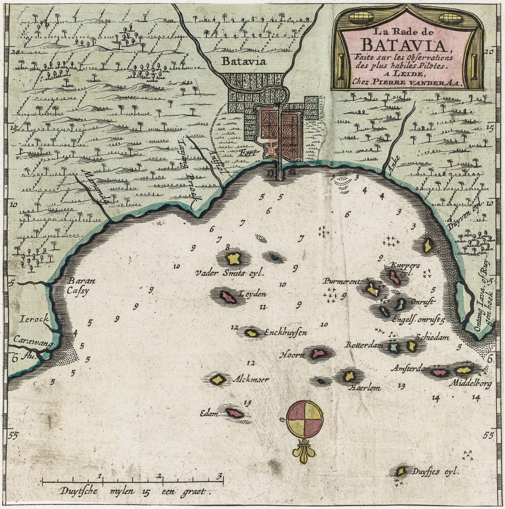
La Rade de Batavia
Pieter van der Aa was a Leiden publisher, bookseller, and engraver active in the late seventeenth and early eighteenth centuries. Although not a mapmaker in the technical sense, he became a prolific compiler and publisher of maps, views, and charts, adapting earlier sources for works such as Le Nouveau Théâtre du Monde (1713), Atlas nouveau et curieux des plus célèbres itinéraires (1714), and La Galerie agréable du monde (1729).
This chart presents Batavia, modern Jakarta, not simply as a city, but as a functioning maritime system. Founded in 1619 as the administrative centre of the Dutch East India Company, Batavia served as the principal hub of Dutch power in Asia.
The fortified grid of the city is shown at the head of the bay, while the roadstead dominates the composition. Depth soundings, anchorages, and named offshore islands structure the surrounding waters, reflecting practical navigational knowledge derived from experienced pilots, described in the title as des plus habiles pilotes. Many of these islands bear the names of Dutch cities, including Leyden, Enckhuyzen, Rotterdam, Amsterdam, and Middelborg, reinforcing the connection between the Dutch Republic and its Asian trading centre.
Unlike the view of Bantam (187), this image is not a picturesque prospect but a working chart. A scale in Dutch miles and the detailed hydrographic information underscore its practical purpose, while also illustrating the consolidation of Dutch maritime control in Java.
Aa, Pieter van der (1659–1733)
Atlas nouveau et curieux des plus célèbres itinéraires, Leiden: Pieter van der Aa, 1714
1714, first
later reissued in La Galerie agréable du monde, Leiden: Pieter van der Aa, c. 1729
Copperplate engraving
190
R2 Very rare - one or two copies appear on the market