
Tabula Anemographica seu Pyxis Nautica ventorum nomina sex linguis repraesentans
Johannes Janssonius was an Amsterdam publisher, bookseller, and mapmaker who became one of the leading figures in the continuation of the Mercator-Hondius atlas tradition. In 1612 he married Elisabeth Hondius, daughter of Jodocus Hondius I, and in 1630 he entered into partnership with his brother-in-law Henricus Hondius. Their Atlantis maioris appendix, sive pars altera of 1630 expanded the Mercator-Hondius atlas project and placed the firm in direct competition with the Blaeu publishing house.
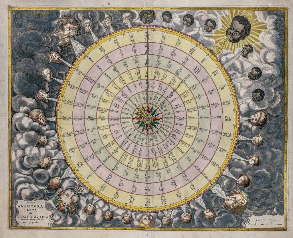
This anemographic chart was included in the maritime volume of Janssonius’s Atlas novus in 1650. It is not a geographical map, but a diagram of the winds and compass directions, intended for readers of a sea atlas.
The chart presents thirty-two wind heads arranged around a compass structure. Their names are given in six languages: Greek, Latin, Italian, Spanish or Portuguese, French, and Dutch. The four cardinal winds are larger and more elaborate. North is associated with rain, east with the Sun, west with flowers, and south with strong billowing wind.
The smaller wind heads are personified through differences in age, complexion, and facial type, reflecting early modern conventions for giving natural forces human form. The upper left quadrant (north), depicts pale, bearded elderly men, while the upper right (east), features beardless, dark-skinned faces. The lower left (west) and right (south) quadrants include beardless, pale-skinned faces arranged in apparent age progression, from young to old.
Janssonius, Johannes (1588–1664)
Atlas novus, vol. 5, part 1, Amsterdam: Johannes Janssonius, 1650
1650, first
Copperplate engraving
206
R2 Very rare - one or two copies appear on the market