
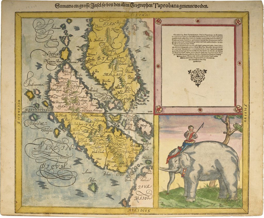
Sumatra ein grosse Insel, so von den alten Geographen Taprobana, ist genent worden
Sebastian Münster was a German humanist, Hebraist, cosmographer, and mapmaker based in Basel. His Cosmographia, first published in German in 1544, was a large illustrated description of the known world, combining geography, history, peoples, cities, natural wonders, and maps. Münster died in 1552, but the work continued to be revised and reissued by the Petri publishing family in Basel.
In 1588, Sebastian Petri issued a substantially revised version of the Cosmographia with a new set of woodcut maps. This map of Sumatra, from the 1592 German edition, belongs to that later Petri revision. It reflects the Cosmographia’s interest not only in mapping places, but also in explaining how ancient geographical names could be reconciled with newer knowledge of Asia and the East Indies. The title identifies Sumatra as the large island formerly called Taprobana by ancient geographers. This was an important and long-running problem in European geography. Classical writers described Taprobana as a major island in the Indian Ocean, but early modern mapmakers and readers disagreed over whether it should be identified with Sri Lanka, Sumatra, or another island altogether. Münster’s map presents Sumatra as a specific island of Southeast Asia while still linking it to this older classical name.
The map shows Sumatra, the Malay Peninsula, parts of Java, the Sunda Strait, and surrounding islands. It is oriented with south at the top, as indicated by the border labels, so Java appears to the right and the Malay Peninsula to the upper right. Major regions and place names are marked across Sumatra, while the surrounding seas are decorated with bold calligraphic labels. On the right, a German text panel discusses Taprobana through classical authorities, including Pliny and accounts associated with Alexander the Great. Beneath it, a large image of a mahout riding an elephant gives the map a strong pictorial emphasis. The elephant connects Sumatra with European ideas of the riches, animals, and marvels of the Indies.
Within the collection, this map is closely connected with Münster’s broader Asia map from the same 1592 edition (394), and alongside his earlier maps of eastern Asia and Southeast Asia (5 and 96). On the verso beneath a decorative cartouche, is the text: Taprobana. Taprobane der Insel Beschreibung so in dem Indianschen Meere ist gelegen. rriij. (The description of Taprobana, an island located in the Indian Ocean).
Münster, Sebastian (1488–1552)
Cosmographei oder beschreibung aller länder..., vol. 6. Basel: Sebastian Petri, 1588
1592, second
Woodcut
395
R1 Extremely rare - occasionally seen on the market