
Pascaert vande Zuyd Zee en een gedeelte van Brasil van ilhas de Ladronos tot R. de la Plata
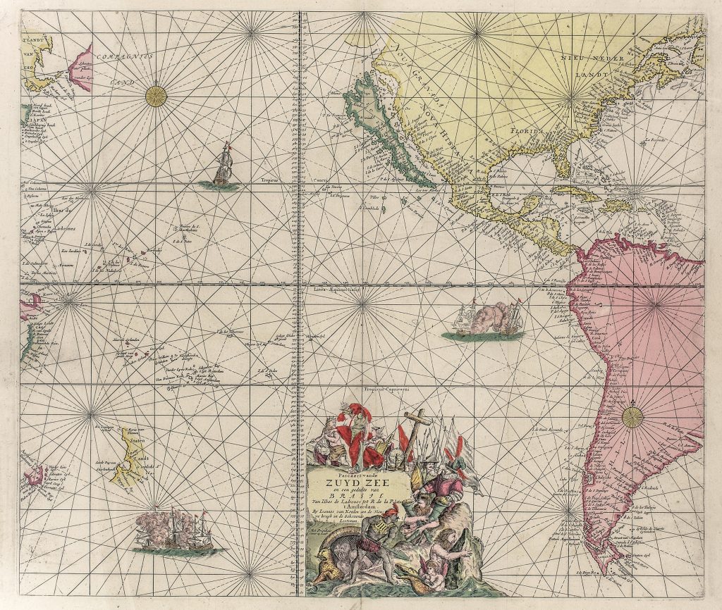
Johannes van Keulen I founded the Amsterdam publishing house In de Gekroonde Lootsman in 1678 and quickly established it as a major producer of maps, nautical charts, atlases, and pilot books. This first state chart was issued in the De groote nieuwe vermeerderde zee atlas ofte water-werelt in 1680. It presents the South Sea, or Pacific Ocean, from the Ladrones in the west to the Atlantic coast of South America near the Río de la Plata.
The chart shows the Pacific as a vast but only partly known maritime space. On the western side it includes the Ilhas de Ladrones, Japan, Compagnies Landt, Landt van Eso, and island groups scattered across the ocean. On the eastern side it shows the coasts of North, Central, and South America, including California, Mexico, Brazil, and the Río de la Plata region. Rhumb lines, compass roses, sailing ships, and a regular graticule organise this broad oceanic field for navigation. The chart includes important traces of Abel Tasman’s voyages. At the lower left appear Staten Landt, associated with New Zealand, and Anthoni van Diemens Landt, now Tasmania. It also shows the western side of the Gulf of Carpentaria, linking the chart to Dutch knowledge of northern Australia. These details show how Tasman’s discoveries had entered Dutch printed sea charts by the later seventeenth century.
The decorative title cartouche combines European, Indigenous, mythological, and maritime figures, presenting the South Sea as a region of exploration, encounter, danger, and commercial possibility. Ships appear across the chart, including scenes of naval action, reminding the viewer that Pacific navigation was tied not only to discovery and trade, but also to imperial rivalry.
This chart is closely connected with Doncker’s earlier Pacific chart (203), Dudley’s South Sea charts (222and 276), and Delisle’s later southern-hemisphere map (237). It also connects with Van Keulen’s East Indies charts (83, 95, and 266), which map the western approaches to the same oceanic world. Together, these works trace European efforts to organise the Pacific before its geography was substantially revised by eighteenth-century exploration.
Keulen I, Johannes van (1654–1715)
De groote nieuwe vermeerderde zee atlas ofte water-werelt, Amsterdam: Johannes van Keulen I, 1680
1680, first
Copperplate engraving
182
R2 Very rare - one or two copies appear on the market