
Pascaart van zuyd zee tusschen California en Ilhas de Ladrones
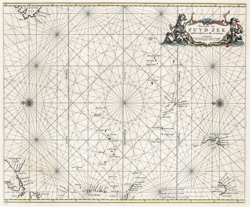
Hendrick Doncker was an Amsterdam bookseller, chartmaker, and hydrographer whose work helped shape Dutch maritime publishing in the mid-seventeenth century. His Pas-Caart van Zuyd-Zee, tusschen California en Ilhas de Ladrones is a large engraved sea chart of the Pacific Ocean, published in Amsterdam in the 1660s. Oriented with east at the top, it presents the South Sea as a wide navigational field stretching between California, Japan, the Ladrones, the South Pacific, and the western coast of South America.
The chart reflects the uneven state of European knowledge of the Pacific before the major eighteenth-century voyages of exploration. Some regions are drawn from repeated Spanish and Dutch navigation, while others remain speculative or only partially understood. California is shown as an island, and Compagnies Landt appears in the North Pacific, reflecting persistent uncertainty about the lands north of Japan and their possible relationship to America. Doncker’s chart is especially significant for its incorporation of Tasman-related geography. A.t van Diemens Landt appears in the lower right, and Staten Landt is shown further north-east with a note recording its discovery in 1643. These features connect the chart to Abel Tasman’s first voyage of 1642–43 and to the gradual entry of New Zealand, Van Diemen’s Land, and the southwest Pacific into Dutch printed sea charts.
The chart’s open spaces are structured by rhumb lines, compass roses, tropics, and the equator rather than by dense inland geography. This reflects its purpose as a sea chart: it is concerned less with territorial interiors than with oceanic positioning, island groups, routes, and the practical organisation of maritime space. Its sparseness is part of its historical meaning, showing how much of the Pacific remained uncertain to European chartmakers in the seventeenth century.
This chart is closely connected with Doncker’s East Indies charts in the collection (33, 234, and 347), which map the western approaches to the same maritime world. It also relates to Van Keulen’s later South Sea chart (182), Robert Dudley’s Pacific charts (222and 276), especially in their treatment of the Solomon Islands and the wider South Sea, and to Delisle’s later southern-hemisphere map (237). Together, these works show how seventeenth- and eighteenth-century mapmakers wrestled with the still uncertain geography of the Pacific, including the placement of island groups, New Zealand, Van Diemen’s Land, and the wider South Sea.
Doncker, Hendrick (1626–1699)
Zeeatlas and/or Nieuwe Groote Vermeerderde Zeeatlas, Amsterdam: Hendrick Doncker, 1666
1666, first
Copperplate engraving
203
R2 Very rare - one or two copies appear on the market