
Mar di India
Johannes Janssonius was an Amsterdam publisher, bookseller, and mapmaker who became one of the leading figures in the continuation of the Mercator-Hondius atlas tradition. In 1612 he married Elisabeth Hondius, daughter of Jodocus Hondius I, and in 1630 he entered into partnership with his brother-in-law Henricus Hondius. Their Atlantis maioris appendix, sive pars altera of 1630 expanded the Mercator-Hondius atlas project and placed the firm in direct competition with the Blaeu publishing house.
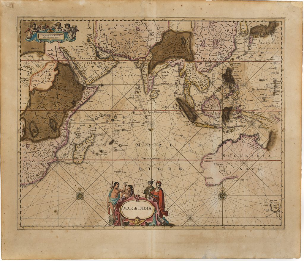
Beginning in 1638, the atlas was renamed Atlas novus and expanded to three volumes. A fourth volume was added in 1646, followed by a fifth in 1650, which was split into two parts: Atlas maritimus (Part 1) and Atlas antiquus (Part 2). Part 1 included a map of the Indian Ocean (34).
By the 1664 issue, the map had been updated with post-Tasman geography, in the context of competition with Joan Blaeu’s Atlas Maior. Janssonius included an outline of Terre del Zur (Australia) but added Hollandia Nova. He retained the early Dutch discoveries along Australia’s western and southern coasts (34), while also including the discoveries from Abel Tasman's first voyage of 1642-43, notably the addition of Van Diemen's Land (now Tasmania), named after Anthony van Diemen, the governor of the Dutch East Indies. The map also reflected the discoveries from Tasman's second voyage of 1644 to the northern and western coasts of Australia.
Janssonius, Johannes (1588–1664)
Atlas novus, vol. 5, part 1. Amsterdam: Johannes Janssonius, 1650
1664, second or later state
Copperplate engraving
255
R1 Extremely rare - occasionally seen on the market