
Map for Mr Pennants Outline of the Globe
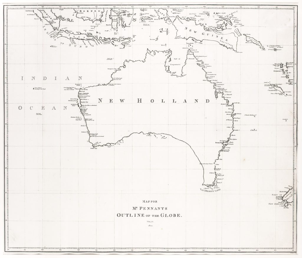
Thomas Pennant was a Welsh naturalist, traveller, and writer whose Outlines of the Globe attempted to assemble geographical and natural-historical knowledge of distant regions for British readers. Although Pennant himself did not visit many of the places he described, his work drew together published voyages, reports, and natural-history observations into a broad survey of the world. This map was issued in vol. 4 of Outlines of the Globe, The View of the Malayan Isles, New Holland, and the Spicy Islands, published in London in 1800.
The map appears to be rarely recorded separately and is noted by Robert Clancy as one of only two printed appearances of the supposed strait before Flinders’s account. Although Van Diemen’s Land is still shown joined to the mainland, the map includes a note referring to the “supposed newly discovered straits, ” reflecting reports of a channel before its formal confirmation by George Bass and Matthew Flinders during their 1798–99 circumnavigation of Van Diemen’s Land in the Norfolk.
Those reports followed the wreck of the Sydney Cove in 1797. Observations of south-westerly swell, tides, and currents around Preservation Island suggested that Van Diemen’s Land might be separated from the mainland by a channel linking the Pacific and southern Indian Ocean. Pennant’s map is therefore important not because it fully revises the coastline, but because it records a moment of uncertainty just before the new geography was fixed in print.
Within the collection, this map is directly connected with Pennant’s Outlines of the Globe, vol. 4 (456), from which it comes. It also belongs with other early Australian mapping concerned with coastal knowledge, inland exploration, and the gradual correction of inherited geography, including Oxley’s A Chart of Part of the Interior of New South Wales (166), Allan Cunningham’s exploration map (170), and later New South Wales survey maps such as Thomas Livingstone Mitchell’s map of southeastern Australia and his expedition routes (179) and Robert Dixon’s map of appropriated lands in New South Wales (267).
Pennant, Thomas (1726–1798)
1800, Unrecorded
Copperplate engraving
178
Unrecorded