
General map of the south-eastern portion of Australia
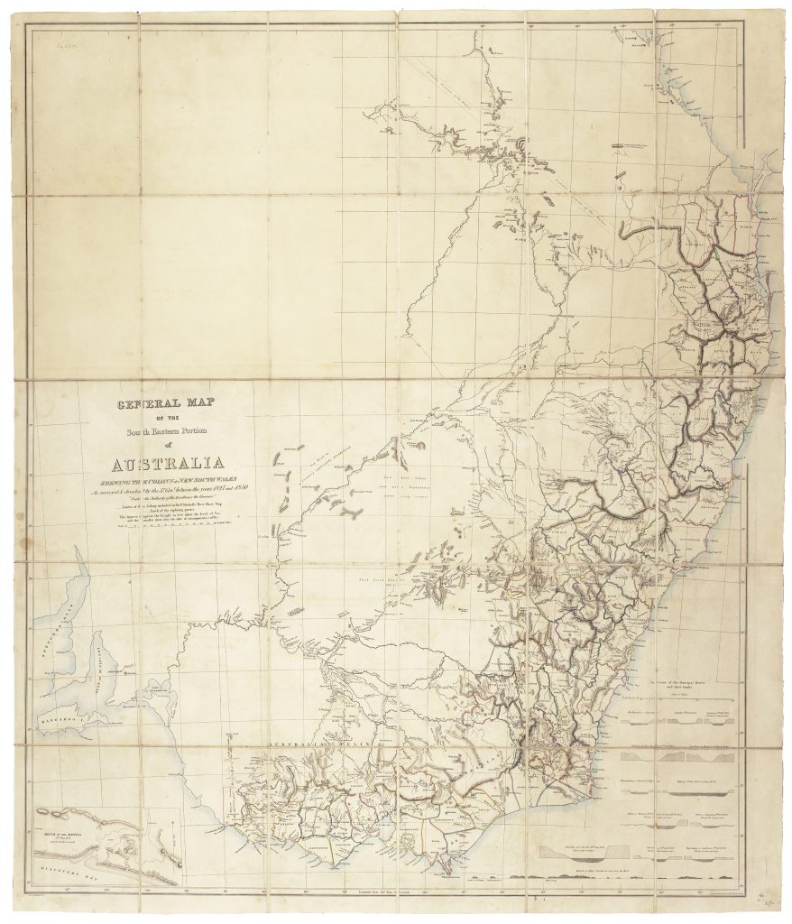
Thomas Livingstone Mitchell was a British soldier, surveyor, and explorer who served as Surveyor-General of New South Wales from 1828. This large General Map of the South Eastern Portion of Australia presents the colony of New South Wales “as surveyed & divided” by Mitchell between 1827 and 1850. It brings together more than two decades of official survey, exploration, land division, and route mapping into a single image of southeastern Australia.
The map extends from southern Queensland through New South Wales and into Victoria, with South Australia at the left. It records counties, districts, roads, rivers, mountain ranges, settlements, exploration routes, and colonial boundaries. Mitchell’s own surveying work is central, but the map also places his work within a broader history of inland exploration, including routes associated with Hamilton Hume and Charles Sturt. The map is especially useful because it shows the transition from exploration to administration. Earlier expedition maps traced journeys through partly known country; this map converts that accumulated knowledge into a more systematic colonial geography of roads, boundaries, land divisions, and named regions. It presents southeastern Australia not simply as country traversed by explorers, but as territory being surveyed, divided, and governed.
The map also records traces of Aboriginal presence and knowledge within the surveyed landscape. These include notes referring to Aboriginal people and local information, as well as an Aboriginal burial ground south of Lake Three Guns, southeast of the Darling River. Such details sit within a colonial survey map, but they are important because they show that the landscape Mitchell mapped was already known, used, and understood by Aboriginal people.
Within the collection, this map is closely connected with Mitchell’s earlier Map of the Colony of New South Wales (50), his Three Expeditions into the Interior of Eastern Australia (49), and the expedition map issued with that work (179). It also relates to earlier survey and exploration maps by John Oxley (166), Allan Cunningham (170), and Robert Dixon (267), showing the accumulation of geographical knowledge that underpinned the colonial mapping of southeastern Australia.
Mitchell, Thomas Livingstone (1792–1855)
Separate publication, Sydney: J. Carmichael for the New South Wales Surveyor-General, [1850?]
1850
Copperplate engraving
448
R2 Very rare - one or two copies appear on the market