
Carte Particuliere Des Costes De L Afrique Depuis C.
Del Gado Jusques Rio
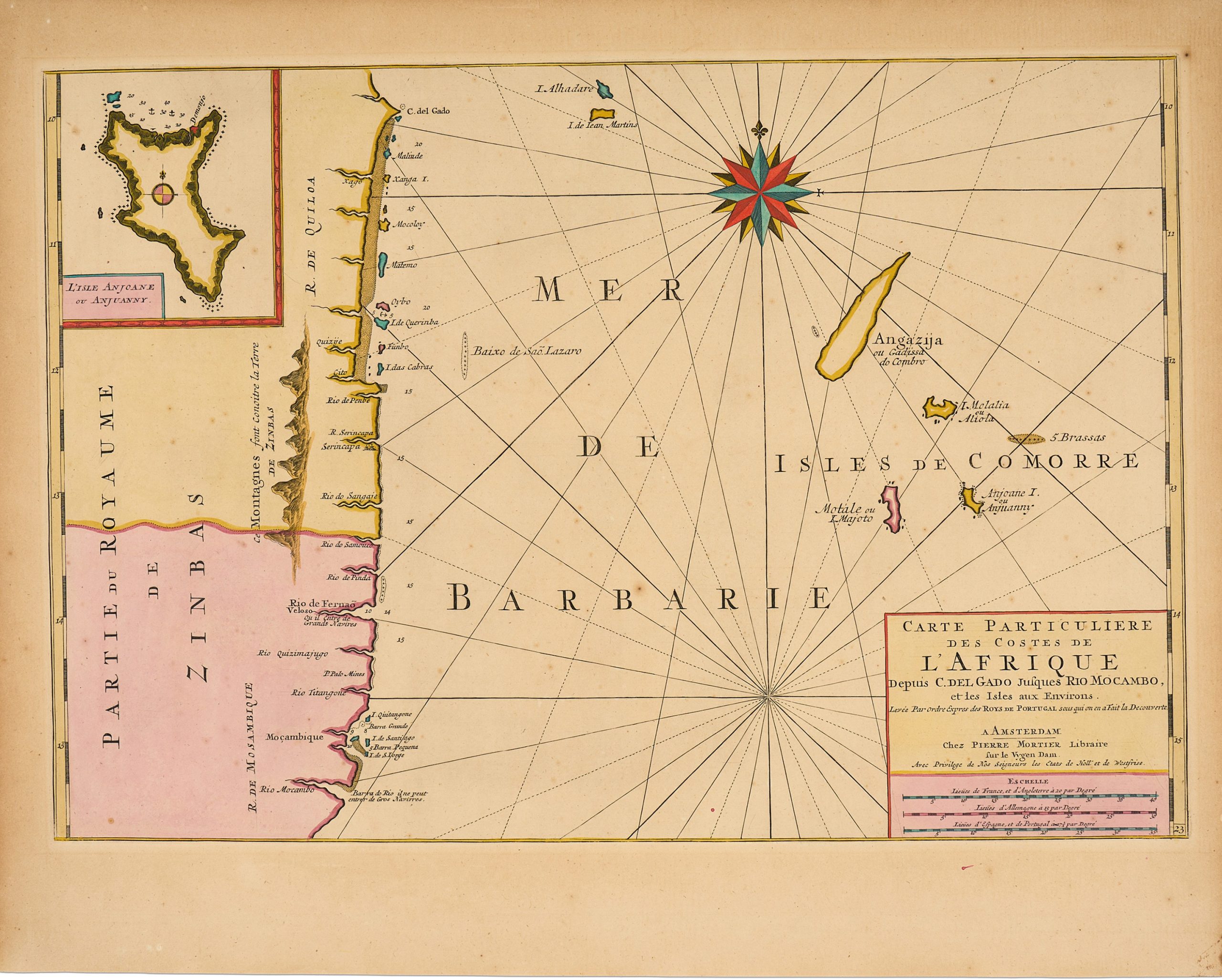
This finely engraved chart of the eastern coast of Africa and the western Indian Ocean was issued in 1708 as part of Pierre Mortier’s expanded edition of the Neptune François.
The atlas, originally published in 1693 through a collaboration between Hubert Jaillot in Paris and Mortier in Amsterdam, became one of the most influential nautical works of the late seventeenth and early eighteenth centuries.
The chart extends from Cape Delgado in the north to the Rio Mocambo, just south of the island and city of Mozambique, and extends eastward across the western Indian Ocean.
It is particularly significant for its early and detailed depiction of the Comoro Islands, here shown and named individually: Grande Comore (Ngazidja), Mohéli (Mwali), Anjouan (Ndzuani), and the disputed island of Mayotte, identified under its early name Motale.
An inset in the upper left further highlights Anjouan, underscoring the strategic importance of the archipelago as a navigational and commercial staging point along Indian Ocean maritime routes linking East Africa, Arabia, India, and Southeast Asia.
The coastal nomenclature reflects a strong reliance on Portuguese hydrographic sources, consistent with Portugal’s early dominance in Indian Ocean navigation.
A boldly engraved compass rose occupies the upper central portion of the chart, reinforcing its practical navigational function while also enhancing its visual authority.
Following Mortier’s death in 1711, the plates were acquired by Gerard van Keulen, under whose imprint the chart continued to circulate, attesting to its enduring navigational and commercial value.
Mortier, Pierre (1661–1711)
Neptune François, Amsterdam: Pierre Mortier, 1708
1708, First
Later states were published by Gerard van Keulen after he acquired the plates sometime before 1726.
These editions bear his imprint
Copperplate engraving
471
R2 Very rare - one or two copies appear on the market