
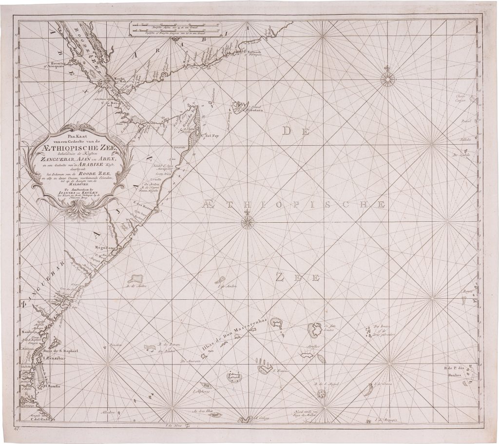
Pas-Kaart van een Gedeelte van de Aethiopische Zee
The Van Keulen publishing house, In de Gekroonde Lootsman (“In the Crowned Pilot”), was founded in Amsterdam by Johannes van Keulen I in 1678 and became one of the leading Dutch firms producing maps, sea charts, atlases, and pilot books.
After Johannes I and his son Gerard developed the business, it passed to Gerard’s son, Johannes van Keulen II.
Johannes II is especially known for issuing the sixth and final volume of De nieuwe groote lichtende Zee-fakkel in 1753, devoted to Asian and Indian Ocean navigation.
The volume brought into print closely guarded VOC hydrographic knowledge, including information derived from manuscript charts and sailing directions that had previously been restricted because of their commercial and strategic value.
The fuller title wording records: Pas-Kaart van een Gedeelte van de Aethiopische Zee, behelsende de Kusten Zanguebar, Ajan en Abex, en een Gedeelte van de Arabise Kust, daarby ook het inkomen van de Roode Zee, en alle in deeze Oceaan voorkomende Eilanden, tot op de langte van de maldives.
This sea chart covers the northwestern Indian Ocean, then commonly described in Dutch hydrography as part of the Aethiopische Zee.
Issued in De nieuwe groote lichtende Zee-fakkel, vol. 6, in 1753, it extends from the Red Sea and Arabian coast to the coasts of Zanguebar, Ajan, and Abex, and eastward across islands, banks, and hazards of the western Indian Ocean toward the longitude of the Maldives.
It records a complex maritime zone linking the Red Sea entrance, East Africa, Arabia, the Maldives, Ceylon, and the wider VOC routes to Asia.
The chart gives particular attention to the waters around Mocha and the Strait of Bab-el-Mandeb, a region important to VOC navigation because of the coffee trade through Mocha and the difficult passage between the Red Sea and the Indian Ocean.
Rhumb lines, compass roses, latitude markings, coastal names, anchorages, soundings, islands, banks, and shoals organise the sheet as a practical guide for long-distance navigation.
This chart is closely connected with Van Keulen’s southern Aethiopische Zee chart (467), which covers Madagascar, Mozambique, and the central Indian Ocean farther south.
It also connects with Van Keulen’s Red Sea entrance chart (306), the Maldives chart (305), and the large VOC chart from the Cape of Good Hope to Canton (270).
Together, these works show how Van Keulen mapped the Indian Ocean as a system of passages, hazards, island groups, and coastal approaches essential to VOC navigation.
Keulen II, Johannes van (1704–1755)
De nieuwe groote lichtende Zee-fakkel, vol. 6, Amsterdam: Johannes van Keulen II, 1753
1753, first
Copperplate engraving
465
R1 Extremely rare - occasionally seen on the market