
India Orien[talis]
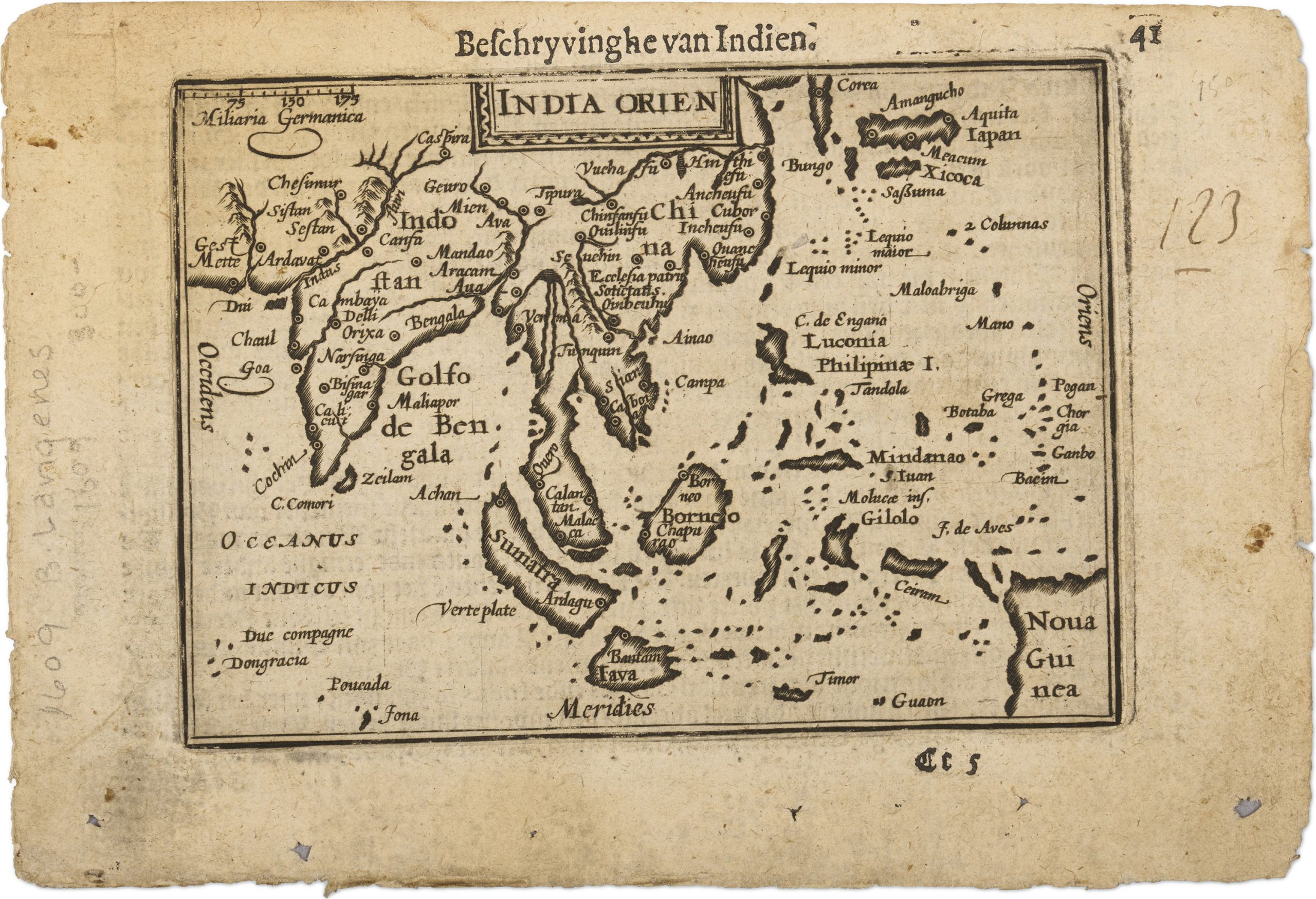
This map first appeared in the Asia section of Caert‑Thresoor, the compact Dutch atlas published in 1598 under the imprint of Barent Langenes and distributed through the Amsterdam publisher Cornelis Claesz.
Designed as an affordable, portable alternative to large‑format atlases, Caert‑Thresoor brought together terrestrial, maritime, and cosmographical material for both scholarly and general audiences.
Most plates were engraved by Pieter van den Keere (View Record (#285),
View Record (#383)), with additional contributions by Jodocus Hondius (View Record (#294), View Record (#295), View Record (#296)).
The
authorship of some maps, such as the East Indies plate (View Record (#388)), remains uncertain and may involve either engraver.
TitledIndia Oriens, the map depicts Southeast Asia, extending from India and the Bay of Bengal eastwards across the Malay Peninsula and the Indonesian archipelago to New Guinea, with southern China visible at the northern edge.
It reflects the rapid expansion of Dutch geographical knowledge in the 1590s, incorporating Portuguese navigational information transmitted through the writings of Jan Huygen van Linschoten and reinforced by early Dutch voyages to the East Indies.
The map is numbered “17” in the upper right corner, indicating its sequence within the atlas, and marked “Cc 5” in the lower right, the printer’s signature denoting the fifth leaf of section Cc.
Langenes, Barent (fl. 1598–1609)
Caert-Thresoor, Middelburg: Barent Langenes, 1598
1598, First
Dutch, French, Latin, and German editions between 1598 and 1650
Copperplate engraving
388
R1 Extremely rare - occasionally seen on the market