
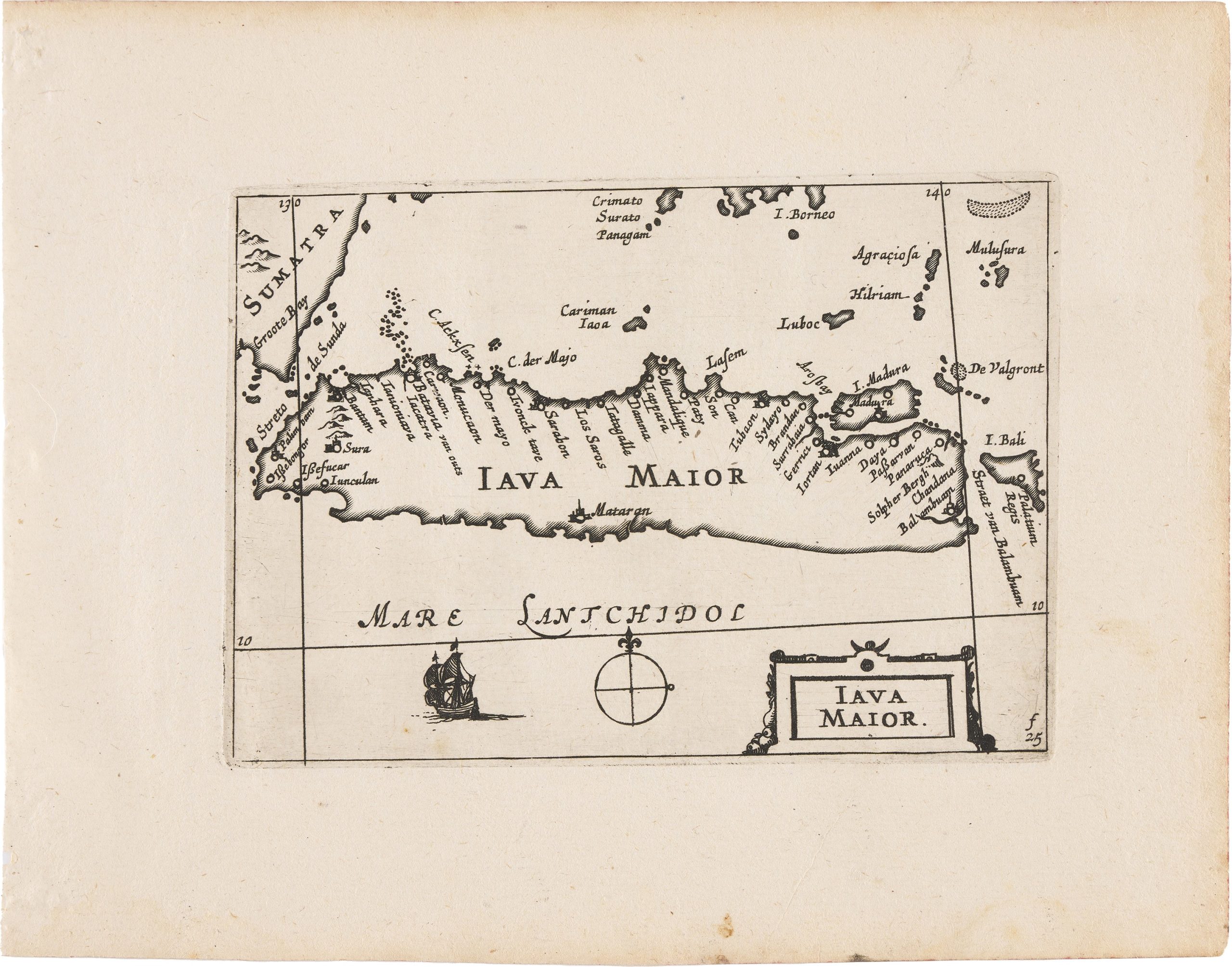
Iava Maior
Claes Jansz.
Visscher was a leading Amsterdam map publisher whose output helped shape Dutch cartography in the first half of the seventeenth century.
He established his publishing house in 1611 on the Kalverstraat, close to leading contemporaries such as Pieter van den Keere (View Record (#8),
View Record (#109), View Record (#122), View Record (#155), View Record (#217), View Record (#273), View Record (#285)) and Jodocus Hondius I (View Record (#80), View Record (#212), View Record (#253),
View Record (#272)).
The firm’s prominence was sustained for over a century by his son Nicolaes Visscher I
(View Record (#25), View Record (#93), View Record (#129), View Record (#287), View Record (#299)) and later by his grandson Nicolaes Visscher II, maintaining its reputation for geographical accuracy and artistic excellence well into the eighteenth century.
Following the death of Cornelis Claesz. in 1612, the copperplates for Barent Langenes’s Caert-thresoor(1598) (#~294, ~View Record (#295), View Record (#296), View Record (#383), View Record (#388)) passed through several hands before being acquired by Visscher.
In 1649, he reissued and expanded this material as Tabularum geographicarum contractarum libri quatuor denuo recogniti, a compact atlas divided into four parts: Europae, Asiae, Africae, and Americae nova descriptio.
Alongside the inherited Caert-thresoor plates, the 1649 edition included twenty-three newly engraved maps, among them ’t Landt van de Eendracht (View Record (#12)), Anthoni van Diemens Landt aldaereerst beseylt ofte ontdeckt by de Schepen Heemskerck ende Zeehaen den 24 November 1642 (View Record (#11)), and this map of Java, as well as several plates engraved by Benjamin Wright (View Record (#369), View Record (#370)).
The atlas also includes two revised world maps, Typus Orbis Terrarum (View Record (#292)) and Iehova(View Record (#293)) both originally engraved fifty-one years earlier by Hondius for Langenes’s 1598 Caert-Thresoor(#~294 ~and View Record (#296)).
In this revised state, Visscher depicts the island of Java (Iava Maior) in its entirety, together with portions of Sumatra to the west and Bali and Lombok to the east.
Coastal place names are densely distributed, especially along the northern shore, reflecting the island’s importance within Dutch commercial and navigational networks during the period of VOC expansion.
The surrounding sea is labelled Mare Lantchidol a name used in Dutch mapping of the East Indies and the Southland.
Decorative elements are restrained, consisting of a simple compass rose and a small ship.
In the lower right corner, the marking “f.25” appears, a binder’s reference indicating the intended position of the sheet within the atlas.
Within Visscher's 1649 atlas, Iava Maior functions as a regional counterpart to the more innovative plates devoted to Australia and Abel Tasman’s discoveries, including ’t Landt van de Eendracht(View Record (#12)) and Anthoni van Diemens Landt aldaereerst beseylt ofte ontdeckt by de Schepen Heemskerck ende Zeehaen den 24 November 1642 (View Record (#11)), situating Java within the broader geography of Dutch expansion in the East Indies.
Visscher, Claes Jansz. (1587–1652)
Tabularum geographicarum contractarum libri quatuor denuo recogniti, Amsterdam: Claes Jansz.
Visscher, 1649
1649, First
Copperplate engraving
371
R1 Extremely rare - occasionally seen on the market