
Anzuani, Cosmoledo, Mayotta en Moelali
The Van Keulen publishing house, In de Gekroonde Lootsman (“In the Crowned Pilot”), was founded in Amsterdam by Johannes van Keulen I in 1678 and became one of the leading Dutch firms producing maps, sea charts, atlases, and pilot books. After Johannes I and his son Gerard developed the business, it passed to Gerard’s son, Johannes van Keulen II. Johannes II is especially known for issuing the sixth and final volume of De nieuwe groote lichtende Zee-fakkel in 1753, devoted to Asian and Indian Ocean navigation. The volume brought into print closely guarded VOC hydrographic knowledge, including information derived from manuscript charts and sailing directions that had previously been restricted because of their commercial and strategic value.
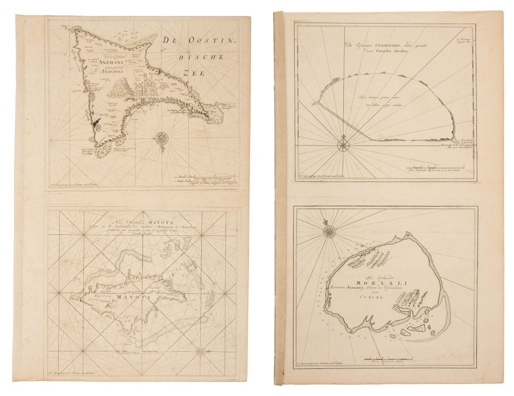
These two sheets contain four nautical charts of islands in the western Indian Ocean: Anjouan, Cosmoledo, Mayotte, and Mohéli. Situated between Madagascar and the East African coast, these islands lay along the sea routes linking the Cape of Good Hope, Mozambique, Madagascar, Arabia, India, and the East Indies. Their harbours, anchorages, reefs, and coastal landmarks were therefore of practical importance to ships navigating the northern Mozambique Channel and adjacent waters.
The charts are constructed as working navigational aids rather than decorative geographical maps. Coastlines, soundings, reefs, anchorages, and coastal profiles are shown within networks of rhumb lines radiating from compass centres. The chart of Cosmoledo records that the atoll was surveyed by Cornelis Jacobsz., a Dutch navigator or surveyor whose observations were incorporated into the VOC's hydrographic records.
Published as part of the VOC's final Zee-fakkel volume, these charts belong to a remarkable body of Dutch hydrographic knowledge that had previously circulated mainly in manuscript form. Within the collection, this sheet should be read alongside Johannes van Keulen II's chart of the Mozambique coast (486), which covers the neighbouring mainland shore.
De nieuwe groote lichtende Zee-fakkel, vol. 6, Amsterdam: Johannes van Keulen II, 1753
1753, first
Copperplate engraving
487
R1 Extremely rare - occasionally seen on the market