
Mar di India
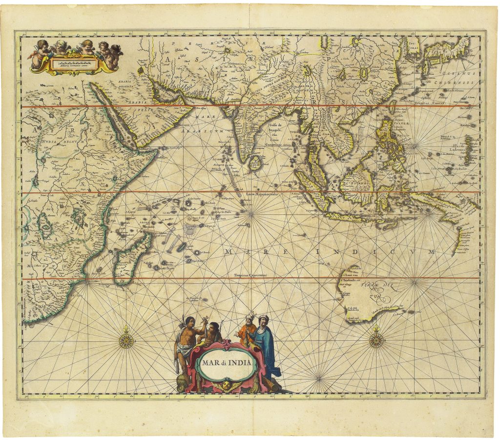
This map of the Indian Ocean, was first published in 1650 in the maritime volume of Janssonius’s Atlas novus. It covers the Indian Ocean from eastern Africa and Arabia to India, Southeast Asia, the East Indies, and Terra del Zur, or Australia.
The map records early Dutch encounters with the Australian coast before the incorporation of Abel Tasman’s discoveries. These include Dirk Hartog’s 1616 landfall at ’t Landt van d’Eendracht, Frederik de Houtman and Jacob d’Edel’s discoveries of 1619, the voyage of the Leeuwin in 1622, Jan Carstensz.’s 1623 exploration of the western side of Cape York Peninsula, Pieter Nuyts’s 1627 voyage along the southern coast in the ’t Gulden Zeepaert, and Gerrit Frederiksz. de Witt’s 1628 contribution to the mapping of the northwest coast.
The chart also records the English ship Trial, wrecked near the Montebello Islands in 1622. Although published after Tasman’s voyages of 1642–1643 and 1644, this first state does not yet show his discoveries. They were added in a later state, represented in the collection by 255.
Janssonius, Johannes (1588–1664)
Atlas novus, vol. 5, part 1. Amsterdam: Johannes Janssonius, 1650
1650, first
Copperplate engraving
34
R2 Very rare - one or two copies appear on the market