
America sive India Nova ad magnae Gerardi Mercatoris avi universalis imitationem in compendium redacta
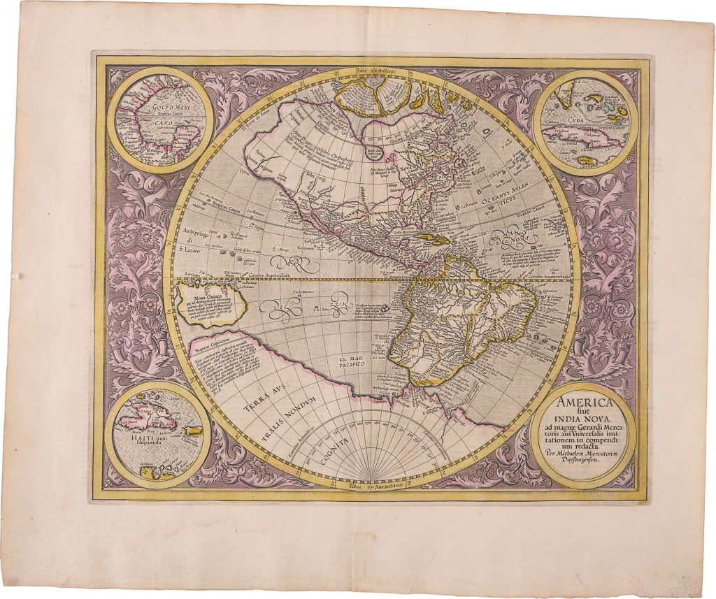
Michael Mercator was the grandson of Gerard Mercator and the engraver of this map of the Americas. The title links the map directly to Gerard Mercator’s larger world geography, stating that it reduces the Americas from the great universal description of Gerard Mercator. First prepared for the 1595 Mercator atlas, the map is one of the few works associated with the third generation of the Mercator family.
The map shows North and South America in a circular projection, framed by insets of the Gulf of Mexico, Cuba, Hispaniola, and the title cartouche. These insets emphasise the Spanish Caribbean and Gulf world, while the main map places the Americas within a wider setting that includes the Pacific, New Guinea, the Arctic, and the southern continent. The west coast of North America remains speculative, with Anian, Quivira, and other northern names preserving ideas about a possible passage between the Atlantic and Pacific. The Arctic retains part of Gerard Mercator’s distinctive polar geography, showing three of the four islands he placed around the North Pole. This connects the map to Mercator’s broader interest in northern passageways and the possibility of routes between the Atlantic and Pacific.
In the south, Terra Australis nondum cognita stretches beneath South America and across the Pacific. New Guinea appears at the western edge of the hemisphere, while Tierra del Fuego and the Strait of Magellan link the map to the long-standing question of whether the far south was island, continent, or something still unknown. The map is interesting because it places the Americas within a wider geography of Atlantic and Pacific navigation. The Caribbean insets point to the Spanish Atlantic world, while New Guinea, the Arctic, and Terra Australis show how the Americas were connected to unresolved questions about northern passages, the Pacific, and the far south.
Within the collection, this map is closely connected with Gerard Mercator’s map of Asia (14) and with other late sixteenth-century maps of the Americas and Pacific, including Giovanni Battista Mazza (219), Fran Hogenberg (130), Abraham Ortelius (219), and Johannes Metellus’s Pacific map (132). Together, these works show how late sixteenth-century mapmakers connected the Americas to the Pacific, New Guinea, and Terra Australis were increasingly mapped as connected parts of a wider oceanic world.
Mercator, Michael (c. 1567–1600)
Atlas sive Cosmographicae meditationes de fabrica Mundi et fabricati figura, Duisburg: Rumold Mercator, 1595
1613, French-text issue, Amsterdam: Jodocus Hondius
Copperplate engraving
464
R1 Extremely rare - occasionally seen on the market