
La Seconde Table Generale Selon Ptol
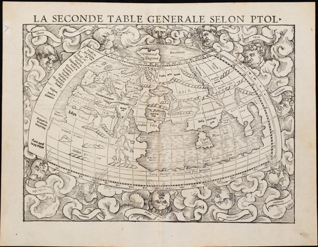
Sebastian Münster was a German humanist, Hebraist, cosmographer, and mapmaker based in Basel. His 1540 Latin edition of Claudius Ptolemy’s Geographia combined ancient Ptolemaic geography with new “modern” maps of the world. Published by Heinrich Petri, the volume included twenty-seven Ptolemaic maps and twenty-one modern maps, including Münster’s modern world map, Typus orbis universalis (91), and this Ptolemaic world map.
This example comes from the 1552 French edition of Münster’s Cosmographia, where the map is titled La Seconde Table Generale Selon Ptol. It corresponds to Münster’s earlier Ptolemaic world map, first published in the 1540 Geographia. Rather than showing the newly expanding world of sixteenth-century navigation, it presents the ancient world according to Claudius Ptolemy’s second-century geographical model. The map shows Europe, Africa, and Asia within a Ptolemaic framework. The Indian Ocean is enclosed by a great southern landmass labelled Terra incognita secundum Ptolemaeum, or “unknown land according to Ptolemy.” This land bridge joins southern Africa to Asia, turning the Indian Ocean into an inland sea. The large island of Taprobana appears prominently, while India is divided into India intra Gangem and India extra Gangem, reflecting classical geographical terminology.
Africa includes several major river systems. The Niger appears in the west, while the Nile rises from three lakes in the interior, differing from Münster’s modern world maps (90and 91), where the Nile’s source is shown as two lakes associated with the Mountains of the Moon. Around the map, wind heads and cloud forms frame the ancient world, giving the image a cosmographical setting as well as a geographical one.
Within the collection, this map is closely connected with Münster’s modern world maps Typus orbis universalis (91and 90). The contrast is important: the modern maps show an open Indian Ocean and a world transformed by Atlantic and Pacific voyages, while this Ptolemaic map preserves an older model in which the Indian Ocean is enclosed by land.
Münster, Sebastian (1488–1552)
Geographia universalis, vetus et nova complectens Claudii Ptolemaei Alexandrini enarrationis libros VIII, Basel: Heinrich Petri, 1540
1552, French
Woodcut
325
R3 Uncommon - dealers can usually obtain a copy