
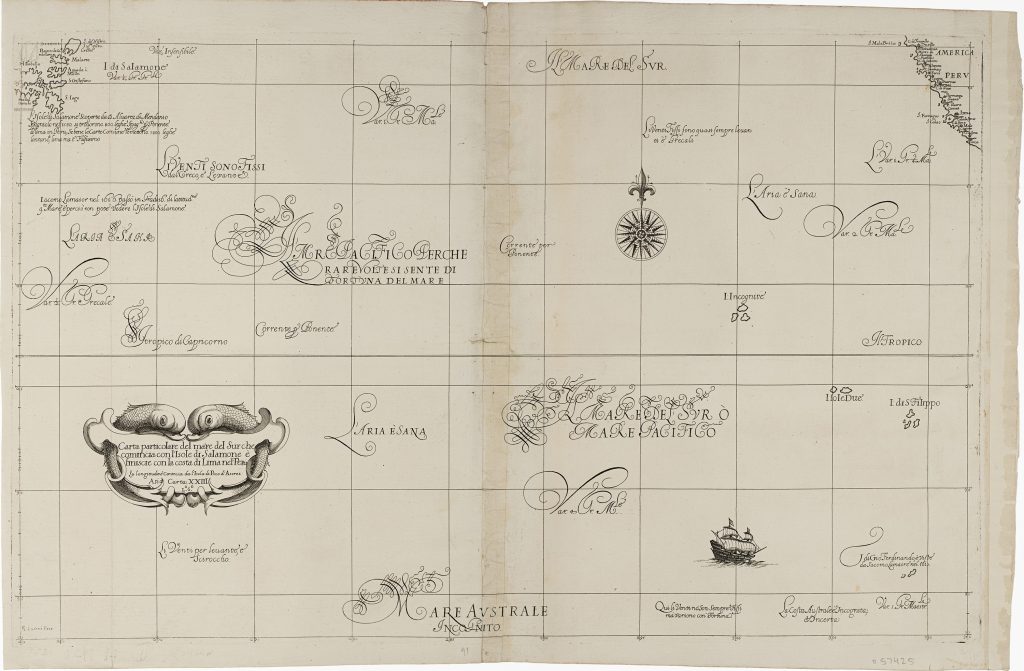
Carta XXIII - Carta particolare del mare del Sur che comincia con l’Isole di Salamone e finisce con la costa di Lima nel Peru
Robert Dudley was an English nobleman, navigator, and cartographer who spent much of his later life in exile in Florence under Medici patronage. His Dell’Arcano del Mare, first published in 1646–47, was reissued in 1661 under the shortened title Arcano del Mare. The atlas was the first printed sea atlas by an Englishman and one of the first to use Mercator’s projection consistently throughout.
This expansive chart of the South Sea, or Pacific Ocean, stretches from the Solomon Islands in the west to the coast of Lima in Peru. Engraved by Antonio Francesco Lucini, it includes the reference “L.o6.o” in the title cartouche, placing it in Book VI of the 1661 edition.
The chart reflects early European efforts to visualise the vast trans-Pacific corridor used by Spanish, Dutch, and English voyagers. It records island groups, winds, currents, and scattered navigational notes across a mostly open oceanic field. The coast of Peru appears at the upper right, while the Solomon Islands and other western Pacific islands are placed at the opposite side of the chart. The result is a sparse but conceptually ambitious image of the Pacific as a navigable space linking the Americas, the South Sea, and the western Pacific.
Within the collection, this chart is closely connected with Dudley’s other Pacific charts (274and 275), his general chart of Asia (222), and Vincenzo Coronelli’s later Mare del Sud (120). Together, these works show how seventeenth-century mapmakers attempted to give form to the Pacific through Spanish, Dutch, and English voyage knowledge, while leaving many island groups uncertain or conjectural.
Dudley, Robert (1574–1649)
Dell’Arcano del Mare, 3 vols. Florence: Francesco Onofri, 1646–47
1661, second
Copperplate engraving
276
R2 Very rare - one or two copies appear on the market