
Asia Maior
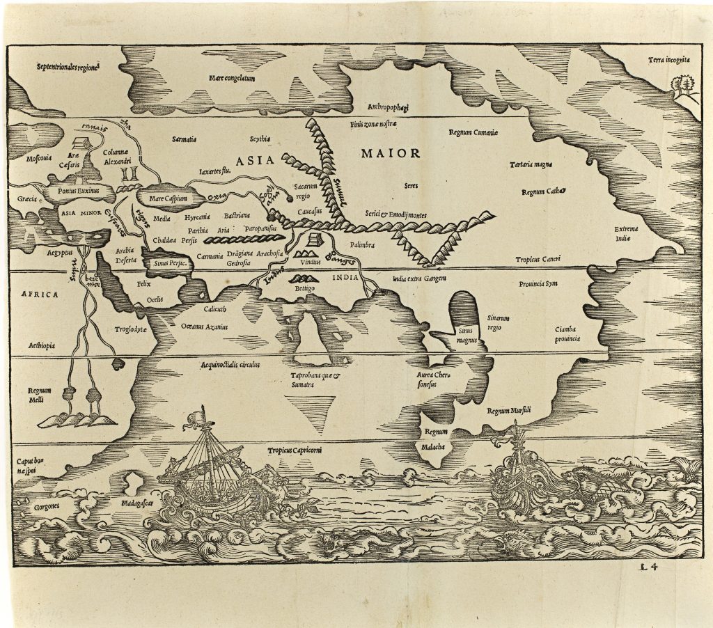
Sebastian Münster was a German humanist, Hebraist, cosmographer, and mapmaker based in Basel. In 1538, Michael Isingrin and Heinrich Petri published a composite edition of two ancient geographical texts: Gaius Julius Solinus’s Polyhistor and Pomponius Mela’s De orbis situ, both edited and updated by Sebastian Münster. Between the two texts, they included this double-page map of Asia, usually attributed to Münster.
The note opposite the map explains that it represents most of Asia, except Asia Minor, and that Europe and Africa are treated elsewhere in the volume. The note states that “in the present map we have placed Asia as far as its extreme edge to the east, as in our own day it has been explored by men.” This statement is significant because it presents the map not simply as a classical reconstruction, but as an attempt to extend ancient geography into the newly explored regions of Asia and the eastern seas. The map combines inherited classical geography with more recent Renaissance cartographic knowledge. In Africa, the Nile rises from two lakes at the foot of the Mountains of the Moon, and Taprobana que et Sumatra appears in the southern Indian Ocean, showing the continuing uncertainty over whether ancient Taprobana should be identified with Sri Lanka or Sumatra. At the same time, Southeast Asia is given a more recognisably modern form, with Regnum Malacha, Ciamba provincia, and Regnum Cathay marking Malacca, Champa, and Cathay.
The seas are enlivened by ships and creatures: one vessel is attacked by a mermaid-like figure, while another is threatened by a sea monster. In the upper-right corner, a small Terra incognita with trees and hills marks the edge of knowledge. These details make the map both a geographical compilation and an image of Asia as a region of ancient authority, recent exploration, commercial possibility, and marvel.
Within the collection, this map is closely connected with Münster’s later modern map of eastern Asia, India Extrema, XIX, nova tabula (5), and the Italian version of the same geography (96). It also provides a useful contrast with Münster’s Ptolemaic map Tabula Asiae XI (363), where Southeast Asia is still organised through ancient geographical categories.
Münster, Sebastian (1488–1552)
Gaius Julius Solinus, Polyhistor, and Pomponius Mela, De orbis situ, Basel: Michael Isingrin and Heinrich Petri, 1538
1538, first
1543, second, without signature
Woodcut
232
R2 Very rare - one or two copies appear on the market