
Maris Pacifici, vulgo mar del zur; Terra Australis sive Magelanica Nondum detecta
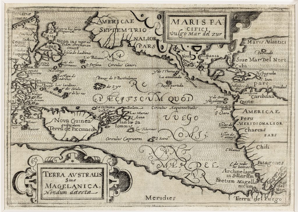
Johannes Metellus was a French humanist and geographer active in the Cologne cartographic publishing world at the end of the sixteenth century. This map of the Pacific was published in the 1598 German edition of José de Acosta’s account of America. Unlike many of the other maps in that volume, which were reduced from Cornelis Wytfliet’s atlas of the Americas, this Pacific map was newly prepared and derives from Abraham Ortelius’s Maris Pacifici (221).
The map focuses on the Pacific Ocean, or Mar del Zur, between Asia and the Americas. Japan, the Philippines, the Ladrones, the Moluccas, New Guinea, and the islands of the western Pacific appear on the left, while the western coasts of North, Central, and South America appear on the right. The Pacific is therefore presented not as empty water, but as a contested and partially known space linking Spanish America with Asia and the East Indies. The southern part of the map is dominated by Terra Australis sive Magelanica nondum detecta, or the southern land, also called Magellanica, not yet discovered. This great southern continent runs beneath the Pacific and approaches Tierra del Fuego near the Strait of Magellan. The map preserves the late sixteenth-century belief that the lands south of the strait might form part of a much larger southern landmass.
New Guinea is shown as Nova Guinea quibusdam Terra de Piccinacoli, indicating uncertainty about its identity and relation to the far south. This uncertainty is central to the map’s interest: the Pacific is shown as a sea of routes and islands, but also as a region bordered by unresolved lands, inherited names, and speculative geography.
Within the collection, this map is closely connected with Ortelius’s Maris Pacifici (221), from which it derives, and with Giovanni Battista Mazza’s map of the Americas and Pacific (219). It also relates closely to Metellus’s southern-continent map Chica sive Patagonica et Australis Terra (226), where the relationship between Tierra del Fuego, New Guinea, and Terra Australis is developed in a different projection.
Metellus, Johannes (1517–1597)
Acosta, José de, Geographische und historische Beschreibung der uberauss grosser Landtschafft America, Cologne: Johann Christoffel, 1598
1598, first
Copperplate engraving
132
R2 Very rare - one or two copies appear on the market