
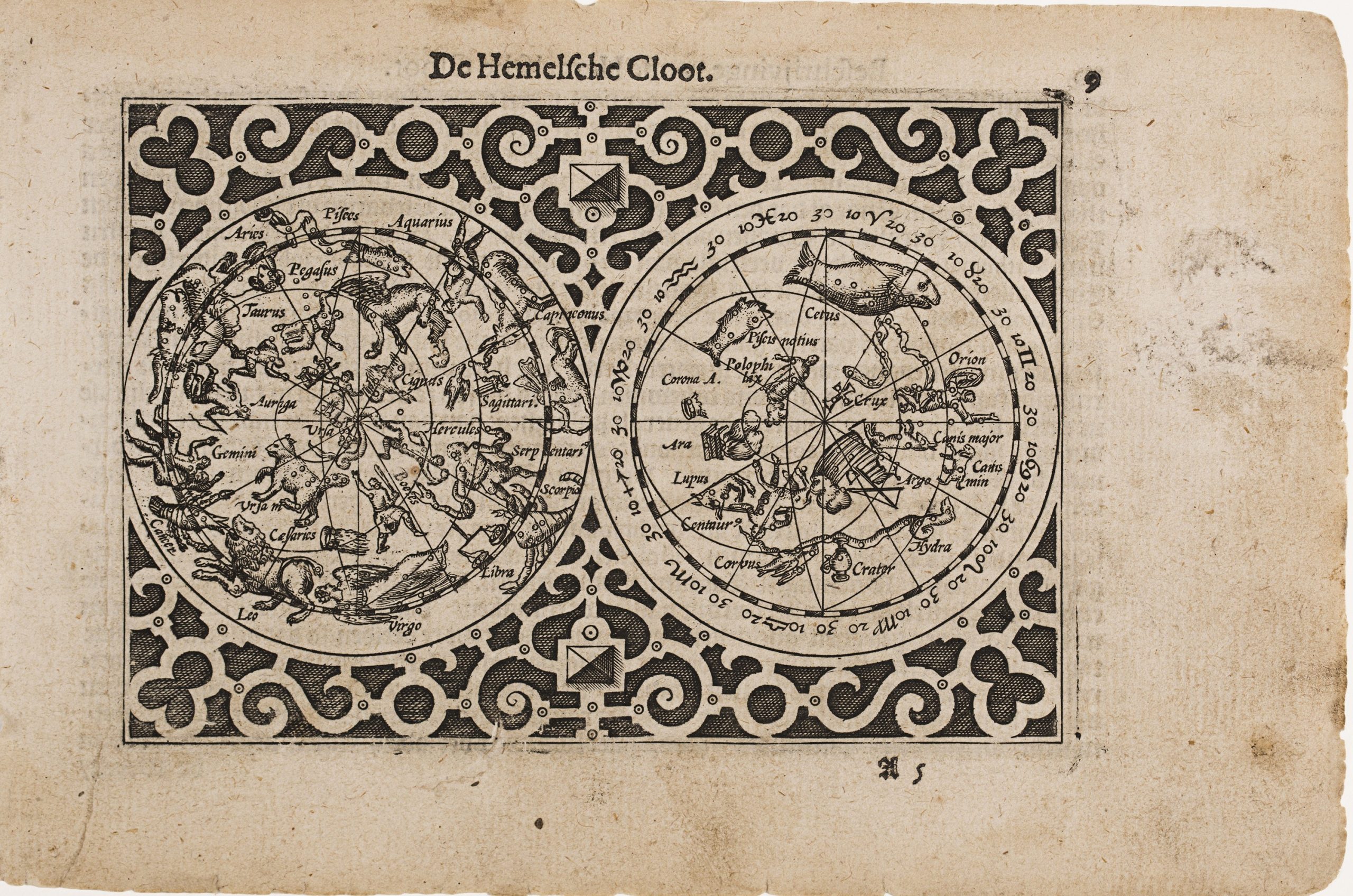
De Hemelsche Cloots
This engraving first appeared in the cosmographical section of Caert‑Thresoor, the compact, Dutch atlas published in 1598 under the imprint of Barent Langenes and distributed through the Amsterdam publisher Cornelis Claesz.
Designed as an affordable, portable alternative to large-format atlases, Caert-Thresoorbrought together terrestrial, maritime, and cosmographical material for both scholarly and general audiences.
Most plates were engraved by Pieter van den Keere (View Record (#285), View Record (#383)), with additional contributions by Jodocus Hondius (including the present plate, View Record (#29)View Record (#4)~,~View Record (#296)).
The authorship of some maps, such as the East Indies plate (View Record (#388)), remains uncertain and may involve either engraver.
This small double-hemisphere celestial map depicts the northern and southern skies populated with mythological constellations, drawing on the Ptolemaic celestial tradition.
Within the atlas, it serves as a cosmographical counterpart to the terrestrial maps, reflecting contemporary ideas about the ordered relationship between the heavens and the Earth.
The map is framed by decorative strapwork and numbered “9” in the upper right corner, indicating its sequence within the atlas.
The printer’s signature “A 5” at the lower right denotes the fifth leaf of section A.
Langenes, Barent (fl. 1598–1609)
Caert-Thresoor, Middelburg: Barent Langenes, 1598
1598, First
Dutch, French, Latin, and German editions between 1599 and 1650
Copperplate engraving
295
R1 Extremely rare - occasionally seen on the market