
Map showing the railway systems of Queensland, New South Wales, Victoria, and South Australia
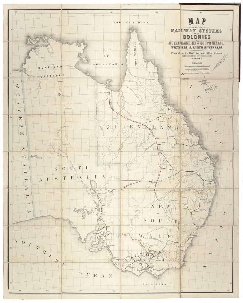
This railway map was prepared by the Chief Engineer’s Office in Brisbane and lithographed by Prosdocimi in 1880. It depicts the railway systems of Queensland, New South Wales, Victoria, and South Australia at a moment when colonial governments were using rail infrastructure to consolidate settlement, connect inland districts to ports, and project future economic growth.
The map distinguishes existing railways, lines under construction, and projected railways across the eastern Australian colonies. It also marks, in red, the proposed Transcontinental Scheme linking the Gulf of Carpentaria with Bourke. This proposed route placed Queensland’s northern and inland ambitions within a wider intercolonial framework, imagining rail as a means of connecting pastoral frontiers, mineral districts, river systems, and ports across the continent.
The map is significant not simply as a railway diagram, but as a visual statement of colonial planning. By bringing together four separate railway systems on a single sheet, it makes visible both cooperation and competition between the colonies before Federation. The different networks had developed under separate governments, with different priorities and, in some cases, incompatible gauges. The map therefore records infrastructure as a political problem as much as an engineering one.
This example is hand-signed by Murray Stanley, Chief Engineer of Railways, and by a second official whose name is partly illegible, and is dated March 1880. Those signatures suggest official circulation or endorsement, possibly in connection with discussion of the proposed transcontinental route. As a lithographed government railway map, the sheet captures the technical ambition, administrative authority, and speculative optimism that shaped railway expansion in eastern Australia in the late nineteenth century.
Chief Engineer's Office, Brisbane
Brisbane: Lithographed by Prosdocimi, 1880, hand-signed by Murray Stanley
1880, first
Lithograph
51
R2 Very rare - one or two copies appear on the market