
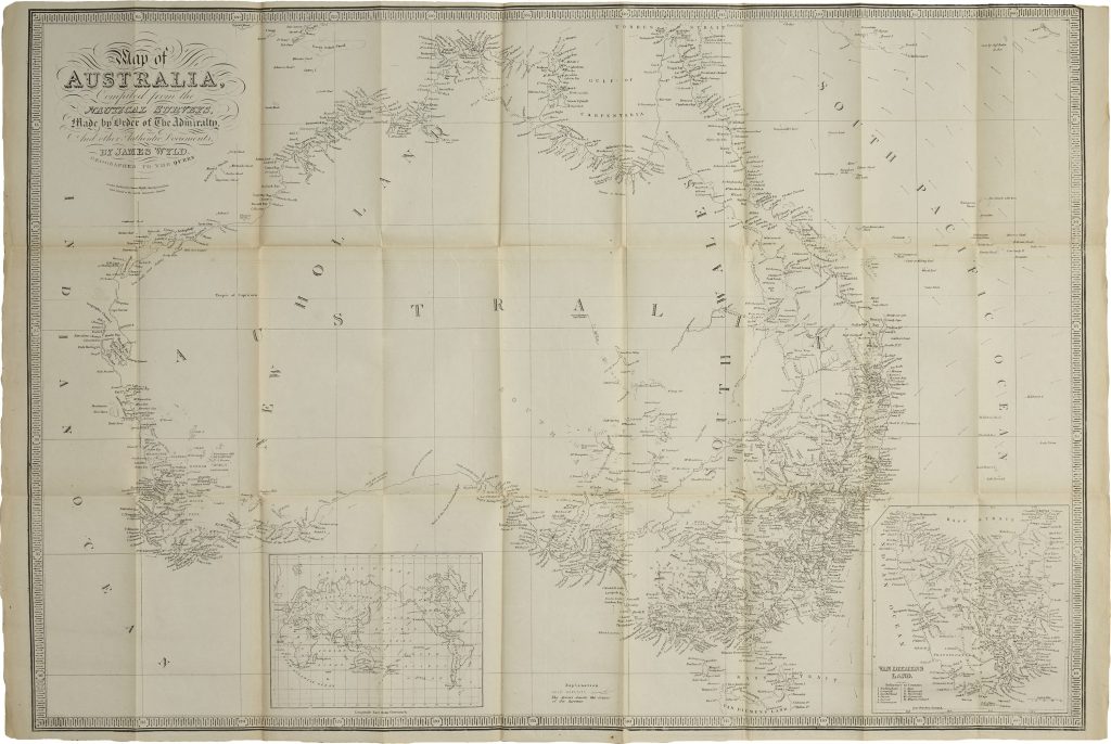
Map of Australia, Compiled from the Nautical Surveys, Made by Order of the Admiralty, and other Authentic Documents by James Wyld Geographer to the Queen
James Wyld Jr. was a London map publisher and geographer to Queen Victoria, following the career of his father, James Wyld Sr., who had also served as royal geographer. After his father’s death in 1836, Wyld Jr. continued the family mapmaking business from premises at Charing Cross and later the West Strand, issuing maps, atlases, globes, and geographical publications for a wide public and official readership.
According to R.V. Tooley, the earliest edition of this map of Australia was published in 1837, but this 1855 version reflects a later stage in the mapping of the continent. Coastal knowledge had been greatly improved by Admiralty surveys, while large areas of the interior remained only partly explored by Europeans. The map shows Australia at a transitional moment in colonial development. Victoria is named, following its separation from New South Wales in 1851, but Queensland is not yet shown as a separate colony, since it was not created until 1859. Western Australia is still labelled New Holland, and Van Diemen’s Land appears in an inset, with its county divisions listed.
The map records county boundaries, settlements, coastal soundings, ocean currents, gold deposits, and exploratory routes. It incorporates recent inland exploration, including Charles Sturt’s 1844–45 expedition into central Australia in search of an inland sea. Sturt’s farthest point, near present-day Milparinka in north-western New South Wales, is marked on the map.
Within the collection, this map is closely connected with William Henry Wells’s cadastral map of the County of Cumberland (164). Together they show two stages in nineteenth-century Australian mapping: Wells’s detailed mapping of colonial landholding around Sydney, and Wyld’s continental synthesis of Admiralty surveys, settlement, goldfields, and inland exploration.
Wyld, James Jnr. (1812–1887)
Separate publication. London: James Wyld Jnr., 1837
1855
Copperplate engraving
418