
Bantam, een stadt gelegen op het eilant Java
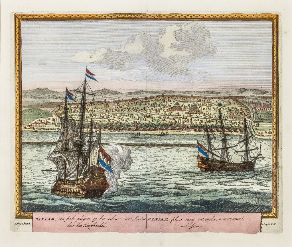
Petrus Schenk was a German-born engraver, print seller, and publisher active in Amsterdam and Leipzig. His publications included maps, views, portraits, and illustrated geographical works for a European market interested in cities, trade, and distant places. This view of Bantam, or Banten, was published in his illustrated city-view book of one hundred notable towns of the world, issued in Amsterdam in 1702.
The bilingual Dutch and Latin title identifies Bantam as a city on the island of Java, celebrated for commerce. The view presents the settlement from offshore, with Dutch ships in the foreground and the walled city extending across the background. The roadstead, anchored vessels, smaller boats, coastal defences, and urban layout all frame Bantam as a trading place rather than simply as a distant landscape.
Bantam was one of the most important ports on the northwest coast of Java before Batavia became the principal Dutch centre in the region. In the sixteenth and early seventeenth centuries, it was a major entrepôt for pepper and other regional commodities, attracting merchants from across Asia and Europe. By Schenk’s time, the image also carried a retrospective significance, presenting Bantam as part of the geography of Dutch commercial expansion in Southeast Asia.
The large ships flying Dutch colours, the smaller boats, and the view from the water all make the harbour the organising feature of the image. The sheet presents Bantam through the conventions of the European city view: recognisable coastline, orderly settlement, commercial shipping, and a caption that explains its importance to trade.
Schenk, Petrus (1660–1718)
Hecatompolis, sive Totius orbis Terrarum Oppida Nobiliora Centum, Amsterdam: Petrus Schenk, 1702
1702, first
Copperplate etching
141
R3 Uncommon - dealers can usually obtain a copy