
A Survey of Port Jackson, New South Wales
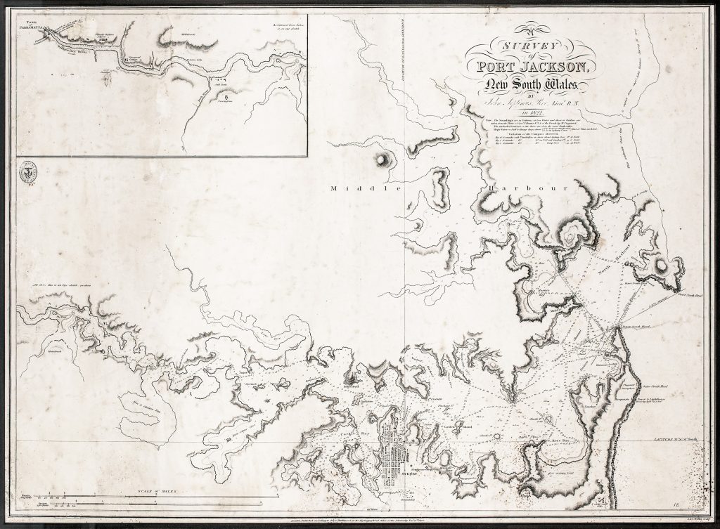
John Septimus Roe, a Royal Navy officer and skilled surveyor, worked under Phillip Parker King in the hydrographic service in New South Wales. Arriving in the colony in 1817, Roe spent the next four years undertaking major coastal surveys and was promoted to lieutenant in 1822.
That same year, Roe completed this detailed nautical chart of Port Jackson, published in London by the Admiralty’s Hydrographical Office in 1826. The chart extends from the Heads westward to “The Flats, ” now Homebush Bay, and along the Parramatta River to Parramatta. It includes soundings in fathoms, tidal information, and important navigational details, including the eastern and western channels at the Heads.
Notable features include Sow and Pigs Reef, Hen and Chicken Reef, the Outer South Head Signal Station, Waterview Bay, later Mort’s Bay, and a street plan of early Sydney. The chart is one of the earliest detailed hydrographic surveys of Port Jackson and provides a valuable record of both maritime conditions and urban growth in early colonial Sydney.
The chart exists in four recorded states: the first, published in 1826 and represented here and in 442, is based on Roe’s 1822 survey; the second, 1839, added Admiralty chart number 1069; the third, 1848, added two large compass roses (see # link); and the fourth, 1856, incorporated corrections to that year (see # link).
Roe, John Septimus (1797–1878)
Separate publication. London: Hydrographical Office of the Admiralty, 1826
1839, second; 1848, third; 1856, fourth
Copperplate engraving
175
R2 Very rare - one or two copies appear on the market