
Descrittione di Tutto'l Mondo, Secondo la prattica de' Marinari
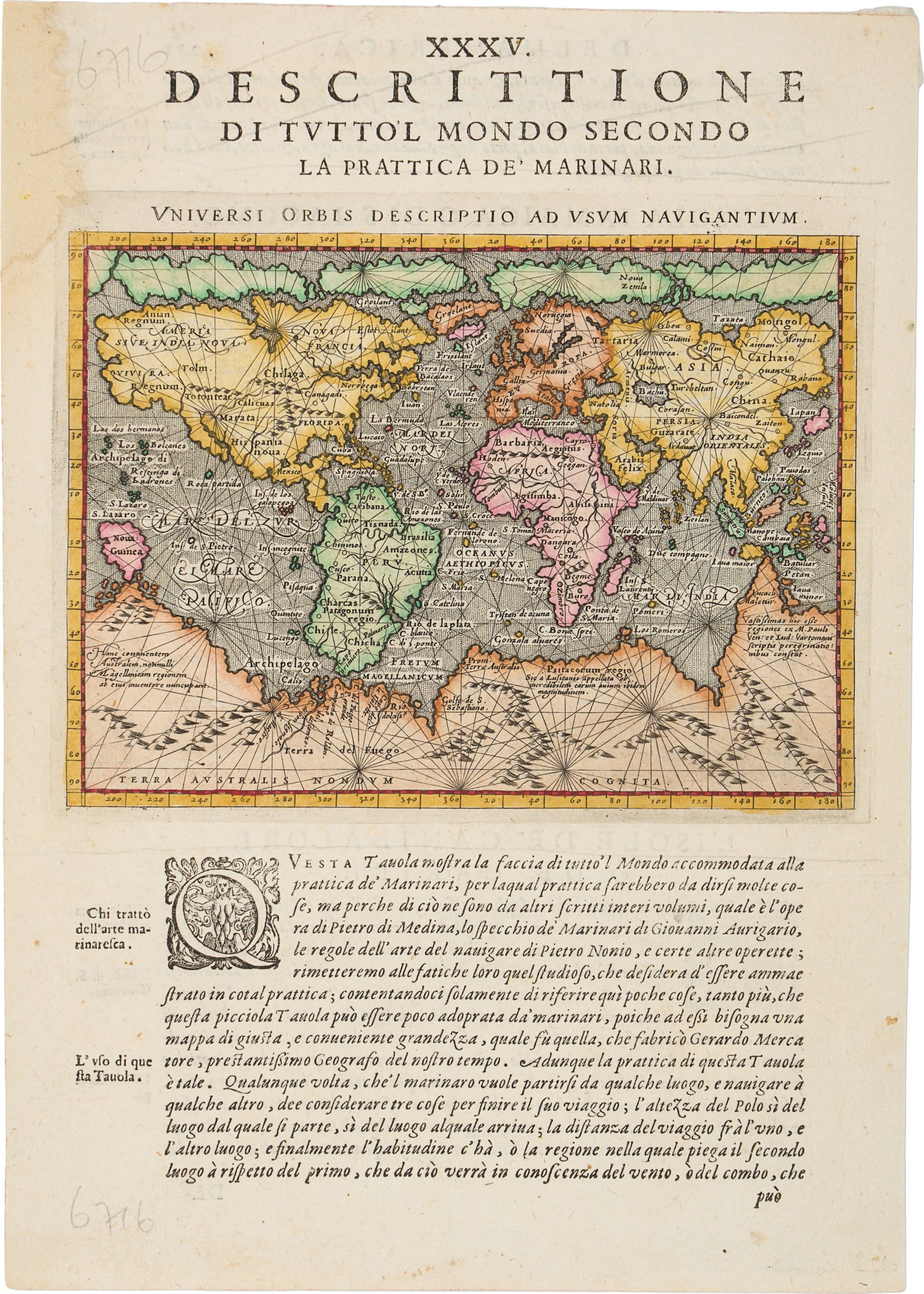
This leaf derives from Chapter 35 of Geografia cioè Descrittione universale della terra byGiovanni Antonio Magini,an influential Italian geographical compendium combining cartographic representation with descriptive text.
The map titled Universi orbis descriptio ad usum navigantium (“Description of the Universal World for the Use of Navigators”), follows Gerard Mercator’s landmark 1569 wall map on a reduced scale, retaining its emphasis on oceanic navigation while introducing imaginative elements, most notably a conjectural mountain range across the Southern Continent (Terra Australis).
The verso contains prose descriptions of several Caribbean islands, introduced by large decorative woodcut initials characteristic of Italian printing of the period.
The islands discussed include Jamaica (L’Isola Iamaica, o di S.
Iacomo), Cuba (L’Isole Cuba, o Fernandina), and the Carib Islands (L’Isole de Canibalori, o de Caribi).
These passages combine geographic observation with early modern European perceptions of the New World, addressing climate, resources, and indigenous populations through the lens of contemporary exploration and maritime experience.
Together, the pairing of a navigational world map on the recto with regional descriptive text on the verso exemplifies the structure of early modern geographical atlases, in which cartography and narrative were intended to function as complementary tools for understanding an expanding global world.
Magini, Giovanni Antonio (1555–1617)
Geografia cioè Descrittione universale della terra partita, vol 2, 1596
1596, First
Copperplate engraving
477