
World map
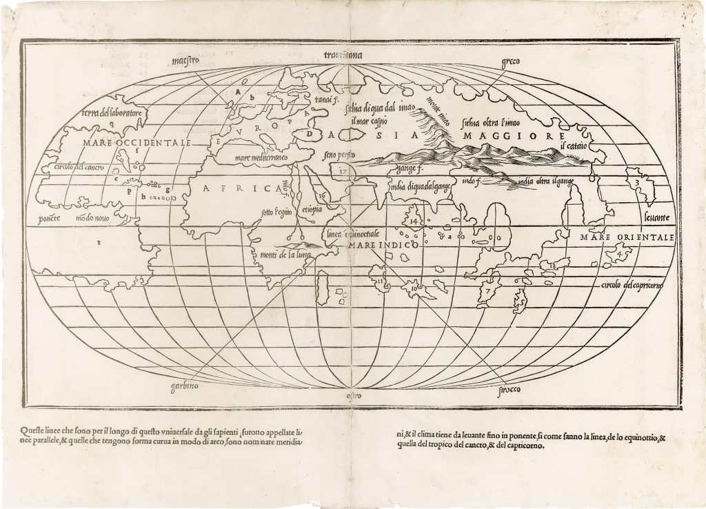
Benedetto Bordone, a Paduan-born miniaturist and illustrator active in Venice, is best known for his Libro nel qual si ragiona de tutte l’isole del mondo (Book of Islands), a landmark isolario first published in 1528. Drawing on classical geography, medieval travel narratives, and early exploration accounts, Bordone’s Libro catalogues 111 islands and peninsulas across the Atlantic, Mediterranean, and Indian Oceans. His maps, while schematic rather than navigational, reflect a transitional cartographic vision, combining compact, stylised layouts with speculative elements characteristic of the early modern geographical imagination.
Located at the beginning of the volume, this schematic world map is the second printed example to employ an oval projection, following Francesco Rosselli’s c. 1508 rendition. While inspired by Rosselli, Bordone’s version omits the southern continent beneath Africa, separates North America from Asia, and presents a truncated South America. Place names are rendered in italic script, with numerals keyed to corresponding maps later in the volume, functioning as a visual index to the contents of the Libro.
Within the collection, related maps include 218(Southeast Asia) and 13(World map).
Bordone, Benedetto (1460–1531)
Libro nel qual si ragiona de tutte l’isole del mondo, Venice: Nicolò d'Aristotile detto Zoppino, 1528
1528, first
Woodcut
7
R1 Extremely rare - occasionally seen on the market