
A Large Draught of the East End of Java and Madura
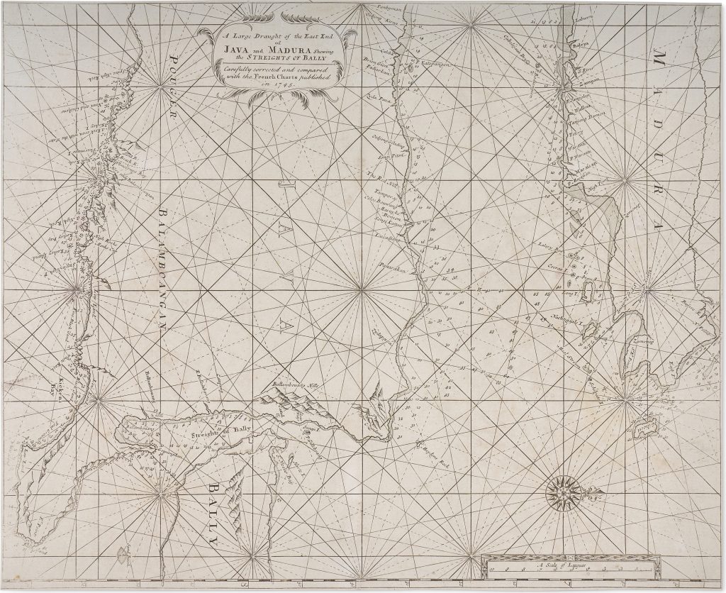
Samuel Thornton, the son of John Thornton, continued the Thornton chartmaking business after his father’s death in 1708. He issued a new edition of The English Pilot. The Third Book … the Oriental Navigation in 1711, but after his death in 1715 the plates and publishing stock were later used by Mount & Page. They continued to issue The English Pilot through the eighteenth century, revising, correcting, and reprinting earlier Thornton charts. The fuller title wording records: A Large Draught of the East End of Java and Madura Shewing the Streights of Bally.
The present example is a later corrected issue produced by Mount & Page. Centred on the eastern end of Java, the island of Madura, and the Bali Strait, it records one of the important passages linking the Java Sea with the waters east of Java. Oriented with west at the top, the sheet gives close attention to coastal outlines, shoals, soundings, islands, anchorages, and navigable channels. Its purpose is navigational. Java, Madura, Bali, and the surrounding islands are represented chiefly as coastlines, approaches, hazards, and sea routes rather than as inland territories. Rhumb lines and compass roses structure the sheet, while soundings and coastal names guide movement through the Bali Strait and adjacent waters. This emphasis reflects the practical needs of European mariners sailing between Batavia, eastern Java, Bali, the islands further east, and the wider routes through the East Indies.
The sheet also shows how English chart publishing continued to draw on Dutch and French hydrographic knowledge. Although the plate originated with the Thornton charts prepared for The English Pilot, this corrected issue reflects the continuing revision of earlier charts by later London publishers in response to new or competing European sources.
Within the collection, this chart is closely connected with Thornton’s broader chart from Banjarmasin to Macassar (398), which places the Bali Strait within the larger island network of Borneo, Celebes, Bali, Lombok, Sumbawa, and Flores. It also relates to Thornton’s chart of the coast of New Holland (102), since the same volume presented English navigators with connected routes through Southeast Asia and toward Australia’s western coast. John Seller’s earlier chart of the eastern East Indies and New Holland (53) provides an earlier English comparison, while Samuel Dunn’s later chart of the Sunda Strait (419) shows the continuing importance of English charting around Java in the eighteenth century.
Thornton, Samuel (1665–1715)
The English Pilot. The Third Book … the Oriental Navigation, London: John How and Samuel Thornton, 1711
1745, Mount & Page corrected issue
Copperplate engraving
399
R2 Very rare - one or two copies appear on the market