
Atlas minor sive tabulae geographicae
Carel Allard was an Amsterdam publisher, engraver, and map seller who continued and expanded the Allard family business after the death of his father, Hugo, or Huych, Allard in 1691. The firm issued separately published maps and atlases, often using plates inherited, acquired, or adapted from earlier Dutch publishers.
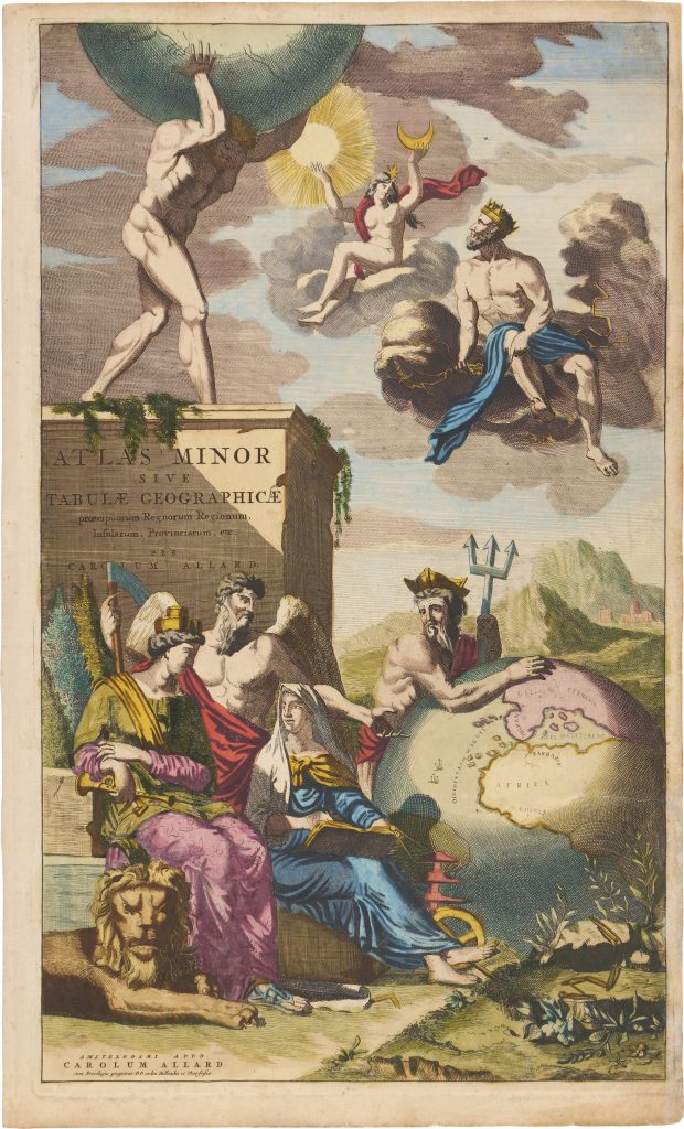
This engraving was made for Allard’s Atlas minor, published in Amsterdam in 1697. The atlas was assembled largely from existing map plates, a common practice in the Dutch map trade, and was later followed by Allard’s more extensive Atlas major in 1705. The composition places the mythological figure Atlas at the centre, standing on a monumental pedestal and supporting the celestial sphere. Around him, classical gods and personifications connect geography with time, maritime power, nature, and measurement.
Neptune gestures toward Europe on a terrestrial globe, using his trident as a symbol of maritime authority. Opposite him, Saturn appears with wings and scythe, representing time. In the foreground, Cybele, crowned with a mural crown and accompanied by a lion, personifies the earth and natural abundance. Beside her, Geography writes in a book while holding dividers, surrounded by instruments associated with measurement, navigation, and mapmaking. Above, Jupiter raises his thunderbolt, while Juno holds the Sun and Moon, linking terrestrial geography with celestial order. The title page frames the atlas as a work concerned with the ordered relationship between earth, sea, time, and the heavens.
Allard, Carel (1648–1709)
Atlas minor sive tabulae geographicae praecipuorum regnorum, regionum, insularum, provinciarum, etc., Amsterdam: Carel Allard, 1697
1697, first
Copperplate engraving
372