
Malay Archipelago or East India Islands
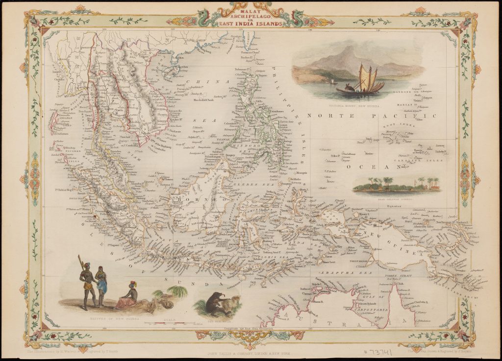
John Rapkin was a British map engraver best known for the maps issued by John Tallis and Company in The Illustrated Atlas, and Modern History of the World. This map of the Malay Archipelago and East India Islands was published in London and New York in 1851, with the map drawn and engraved by Rapkin. The surrounding illustrations were drawn by Henry Warren and engraved by Thomas Smith.
The map covers the Malay Peninsula, Sumatra, Java, Borneo, Celebes, the Philippines, the Moluccas, New Guinea, and the northern coast of Australia. It presents Southeast Asia as an island world between the Indian Ocean, the China Sea, and the Pacific, with dense coastal naming and political colour distinguishing colonial and regional divisions. Northern Australia appears at the lower edge, linking the map to British interest in the Torres Strait, the Gulf of Carpentaria, and the approaches between Australia and Southeast Asia. The decorative vignettes frame the map as a visual geography as well as a cartographic one. They include figures labelled as natives of New Guinea, a “bee bear, ” a view of Victoria Mount in New Guinea, and a view near Sarawak in Borneo. These images reflect the illustrated atlas format of Tallis’s publication, in which maps were made more attractive to a broad reading public through scenes of peoples, animals, landscapes, and settlements.
The map belongs to a mid-nineteenth-century British view of the region shaped by commerce, colonial rivalry, missionary activity, natural history, and navigation. It is later than the Dutch and Iberian sources that first made the Spice Islands central to European cartography, but it continues to present the archipelago as a region of maritime connection between Asia, the Pacific, and Australia. with earlier works that show how European mapping of Southeast Asia and the East Indies changed over time. Abraham Ortelius’s Indiae Orientalis, Insularumque Adiacientium Typus (106), provides an earlier atlas framework for Java, the Moluccas, New Guinea, and the surrounding islands, while Petrus Plancius’s Insulae Moluccae celeberrimae (376and 72), focuses on the Spice Islands as a centre of European commercial ambition. Jean Baptiste Poirson’s Carte réduite de la mer des Indes et de la partie occidentale du Grand Océan (31) places the region within the wider maritime geography of the Indian Ocean and western Pacific.
Rapkin, John (1813–1899)
Martin, R. Montgomery The Illustrated Atlas, And Modern History Of The World Geographical, Political, Commercial & Statistical, London and New York: John Tallis and Company, 1851
1851, first
Later issues were published by the London Printing and Publishing Company
Steel engraving
326
R3 Uncommon - dealers can usually obtain a copy